nev
Super Térrarist
Not working today and the weather was too good to ignore, so I perused the map and picked a spot for lunch. The Logan Pub. Little town with a pub and not much else I've been through a few times, about 3 hours northwest of Melbourne.
Rather than plan a route, I just set a few parameters on the GPS such as No motorways, take a winding route, and then I let it take me whichever way it chose. Occasionally I ignored it's instruction and took a different turn, but once I was out of the burbs I was heading out towards Gisborne. The GPS sent me up one road it thought was a through road (Sandy Creek Rd, Riddells Creek), but I turned back at the first site of a No Road sign. Instead I took the Mt Charlie Road, which winds it's way through the Mt Charlie Flora Reserve.

It was a nice dirt road, but obvious that when it gets wet it would be slippery and muddy. Fortunately today the ruts were solid. It took me out to Mount Eliza Rd in Kerrie, which is my normal route to get to Woodend.

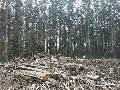
Past the school portable classroom graveyard in Kyneton

The bluestone buildings of Malmsbury


The mechanics institute in Taradale

The Elphingstone pub

The old town hall in Chewton

The remains of the old school in Gower

The Athenaeum hall in Maldon

The anvil on which the world's largest gold nugget (72kg) was cut up in 1869

Around 12:30 I reached Dunolly, with still another 40kg to go to Logan. I was hungry, and it was probably time to turn around so I dumped my plans to head to Logan and started heading south. In the mid 1870s when the train line was first opened up in this region, my great great grandmother was a railway gatekeeper at Carisbrook. Not sure if this was the specific gate that she kept as there are a number of rail crossings in Carisbrook, but the railway station is about 100 metres to the right of this crossing.

A little bit down the street is the old log gaol.

Carisbrook Town Hall constructed in 1859

I stopped for a good lunch at the Britannia Hotel

Water in the Cairn Curran Reservior (almost 100% capacity).

Mechanic's institute in Yandoit

Another detour - Carlsruhe Station Rd.

Mount macedon centre, Hanging rock right, and new picnic shelter on the left in one of the parking facilities serving hanging rock.

I took the Mt Charlie Road back towards home again. Mt Teneriffe Rd was a bit of an uphill climb that's I'll probably explore next time I'm there on a bike weighing 100kg less. Likewise, at the next intersection I turned left into Kent Rd, which deteriorated into a bit of a rutted track. Right where this started was an area I could turn around so I didn't continue, however it would have taken me back to Mt Eliza Rd. Another day, another bike.

Almost home, a snap over the northern subs down to the City from the top of Mt Ridley Rd.

Rather than plan a route, I just set a few parameters on the GPS such as No motorways, take a winding route, and then I let it take me whichever way it chose. Occasionally I ignored it's instruction and took a different turn, but once I was out of the burbs I was heading out towards Gisborne. The GPS sent me up one road it thought was a through road (Sandy Creek Rd, Riddells Creek), but I turned back at the first site of a No Road sign. Instead I took the Mt Charlie Road, which winds it's way through the Mt Charlie Flora Reserve.
It was a nice dirt road, but obvious that when it gets wet it would be slippery and muddy. Fortunately today the ruts were solid. It took me out to Mount Eliza Rd in Kerrie, which is my normal route to get to Woodend.
Past the school portable classroom graveyard in Kyneton
The bluestone buildings of Malmsbury
The mechanics institute in Taradale
The Elphingstone pub
The old town hall in Chewton
The remains of the old school in Gower
The Athenaeum hall in Maldon
The anvil on which the world's largest gold nugget (72kg) was cut up in 1869
Around 12:30 I reached Dunolly, with still another 40kg to go to Logan. I was hungry, and it was probably time to turn around so I dumped my plans to head to Logan and started heading south. In the mid 1870s when the train line was first opened up in this region, my great great grandmother was a railway gatekeeper at Carisbrook. Not sure if this was the specific gate that she kept as there are a number of rail crossings in Carisbrook, but the railway station is about 100 metres to the right of this crossing.
A little bit down the street is the old log gaol.
Carisbrook Town Hall constructed in 1859
I stopped for a good lunch at the Britannia Hotel
Water in the Cairn Curran Reservior (almost 100% capacity).
Mechanic's institute in Yandoit
Another detour - Carlsruhe Station Rd.
Mount macedon centre, Hanging rock right, and new picnic shelter on the left in one of the parking facilities serving hanging rock.
I took the Mt Charlie Road back towards home again. Mt Teneriffe Rd was a bit of an uphill climb that's I'll probably explore next time I'm there on a bike weighing 100kg less. Likewise, at the next intersection I turned left into Kent Rd, which deteriorated into a bit of a rutted track. Right where this started was an area I could turn around so I didn't continue, however it would have taken me back to Mt Eliza Rd. Another day, another bike.
Almost home, a snap over the northern subs down to the City from the top of Mt Ridley Rd.

 Excellent ride report as always
")