|
|
|
You are using an out of date browser. It may not display this or other websites correctly.
You should upgrade or use an alternative browser.
You should upgrade or use an alternative browser.
Welcome to Boring, Oregon.
- Thread starter nev
- Start date

nev
Super Térrarist
Only after, zooming into our photos, that we found out there were at least 11 people climbing El Capitan
And just to put the rock climbers in perspective.. El Capitan is 3000ft from base to summit. It takes the average climber 2-3 weeks to ascend the rock face. They have to carry everything they need during that time, all water, food, climbing gear and they sleep in tents which fix to the cliff face. And even at the time of year that these climbers are on the cliffs, they can expect gale winds, howling rains and snow if the conditions are right.


nev
Super Térrarist
Plan succeeded. The following morning was dry. Grey skies with the odd crack of blue sky.
Southern Idaho was quite desert like. This was close to the Nevada border, so I suppose it was to be expected.

When we got closer to water, we got closer to irrigation and crops, and Idaho is famous for their potato crops

Twin Falls was our destination for the night, and before we got there we stopped at Shoshone Falls, named after the Shoshone people who inhabited this part of the continent before the white folks.

The falls were on the Snake River in the Snake River Canyon. Back in the early 1970s, Even Knievel tried to jump over this canyon. Although famed for motorcycle jumps, this was attempted in a steam powered rocket he named the Skycycle. Initially it was to be launched along the ground and up a ramp, but this was altered to be launched rocket like from a framework which launched the skycycle at about a 45° angle on the south rim. The launch went fine, but the parachute opened prematurely. When it deployed he had already crossed the north rim, but the parachute caught the wind and he was blown back across the river and he landed on the river bank on the south side of the canyon. Fortunately he was relatively unscathed, but even more fortunately the skycycle landed on the ground and not in the river, because the emergency mechanism to unbuckle him from the seat failed, and had he landed in the water he would certainly have drowned.
The original dirt ramp which was build is just out of sight on the left rim of the canyon.


We walked down to the Perrine Bridge over the canyon which is quite spectacular. (My photo was crap, i've had to tinker with the settings to brighten it up a bit so apologies for the nasty colours). There is a local law, or lack of a law, I'm not sure which, which makes it perfectly legal for anyone to BASE jump from the Perrine Bridge any time they like, any day of the year, so this is a destination for skydivers looking for some extra thrill.

It started to rain so we took shelter in a sporting shop. You know.. all the usual sporting and camping goods, parkas, fishing rods, books on how to own automatic rifles, the best ways to carry concealed weapons, and of course dozens and dozens of firearms, so you can choose one that best matches your belt buckle and snakeskin boots.


Southern Idaho was quite desert like. This was close to the Nevada border, so I suppose it was to be expected.
When we got closer to water, we got closer to irrigation and crops, and Idaho is famous for their potato crops
Twin Falls was our destination for the night, and before we got there we stopped at Shoshone Falls, named after the Shoshone people who inhabited this part of the continent before the white folks.
The falls were on the Snake River in the Snake River Canyon. Back in the early 1970s, Even Knievel tried to jump over this canyon. Although famed for motorcycle jumps, this was attempted in a steam powered rocket he named the Skycycle. Initially it was to be launched along the ground and up a ramp, but this was altered to be launched rocket like from a framework which launched the skycycle at about a 45° angle on the south rim. The launch went fine, but the parachute opened prematurely. When it deployed he had already crossed the north rim, but the parachute caught the wind and he was blown back across the river and he landed on the river bank on the south side of the canyon. Fortunately he was relatively unscathed, but even more fortunately the skycycle landed on the ground and not in the river, because the emergency mechanism to unbuckle him from the seat failed, and had he landed in the water he would certainly have drowned.
The original dirt ramp which was build is just out of sight on the left rim of the canyon.
We walked down to the Perrine Bridge over the canyon which is quite spectacular. (My photo was crap, i've had to tinker with the settings to brighten it up a bit so apologies for the nasty colours). There is a local law, or lack of a law, I'm not sure which, which makes it perfectly legal for anyone to BASE jump from the Perrine Bridge any time they like, any day of the year, so this is a destination for skydivers looking for some extra thrill.
It started to rain so we took shelter in a sporting shop. You know.. all the usual sporting and camping goods, parkas, fishing rods, books on how to own automatic rifles, the best ways to carry concealed weapons, and of course dozens and dozens of firearms, so you can choose one that best matches your belt buckle and snakeskin boots.
nev
Super Térrarist
From Twin falls we headed back to the east to Wyoming.
First stop is at the Craters of the Moon National Monument & Preserve. This is an area of volcanic activity. The landscape is quite incredible, vast areas of land looking like a giant plough has turned the top few metres of ground over. All resulting from volcanos and lava flows. As usual, the displays in the visitors centre were outstanding with great exhibits and details, none of which I have shared here .


More of the long flat deserts with the odd volcanic cone


After lunch we hit Wyoming again, and headed for Jackson Hole, via the Teton Pass


The view into Jackson Hole from the top of the pass.

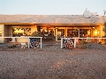
Jackson is a tourist town and ski resort on the southern edge of the Grand Teton & Yellowstone National parks. Plenty of shops selling touristy stuff and plenty of places to dine. They try to maintain the old "wild west" image in part of the town, with large verandas and wooden footpaths.


and some local humour..

First stop is at the Craters of the Moon National Monument & Preserve. This is an area of volcanic activity. The landscape is quite incredible, vast areas of land looking like a giant plough has turned the top few metres of ground over. All resulting from volcanos and lava flows. As usual, the displays in the visitors centre were outstanding with great exhibits and details, none of which I have shared here .
More of the long flat deserts with the odd volcanic cone
After lunch we hit Wyoming again, and headed for Jackson Hole, via the Teton Pass
The view into Jackson Hole from the top of the pass.
Jackson is a tourist town and ski resort on the southern edge of the Grand Teton & Yellowstone National parks. Plenty of shops selling touristy stuff and plenty of places to dine. They try to maintain the old "wild west" image in part of the town, with large verandas and wooden footpaths.
and some local humour..
Williamson
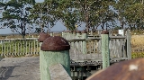
Part of the furniture
Nice pics Nev & Jo, keep them coming.

The standard of some of the roads look good, with sealed (albeit a bit narrow) shoulders, painted edge-lines and tactile edge strips (rumble strips to some of yuse AusTouring bogans). Are these what we would call A, B or C roads in Aust?
I thought I should make some technical comments and ask technical questions, seeing as I'm following this thread at work. But don't worry rate payers, it is not as though I'm not working, I'm doing this in my allocated nap time (ANT is the code we put on our time-sheets).
Last edited:
nev
Super Térrarist
Nice pics Nev & Jo, keep them coming.
The standard of some of the roads look good, with sealed (albeit a bit narrow) shoulders, painted edge-lines and tactile edge strips (rumble strips to some of yuse AusTouring bogans). Are these what we would call A, B or C roads in Aust?
Most of the roads we took were State Highways, which would be A or B roads here.
nev
Super Térrarist
(If you're reading this, it means I haven't edited the photos, so read it again later when I have access to a more modern computer and hopefully a couple of the pictures will have improve a little.)
Next morning we were up early, and found a bakery in Jackson to buy some lunch to take with us on our ride into Yellowstone National Park.
First port of call was the turnoff into Grand Teton National Park. At the other national parks we'd been to, we'd paid cash for the cheapest entry, which for Zion and Bryce Canyon was $12/person, for which they issued a 7 day entry permit, although we only stayed a few hours. The Entry to Grand Teton/Yellowstone was $20/person. The lady at the gate taking entry fees said something about an annual pass, which was $80 and would let us both in to any other national parks. I said, if only someone had told me at the first national park we got to how much the permits were going to cost, I'd have bought one at the start of the trip. "do you still have your receipts?". Sure did, I just stuffed them all into the map window on the tankbag. She said there's an expiry date on the bottom. We'd gone through Zion and Bryce Canyon 6 days earlier, so the expiry on those was for tomorrow. No problem she said. They're still valid so I can sell you an annual pass, and refund these two already paid for passes, so the entry fee today was $32 total, and that would cover us for any other parks we went through. Sweet.. on with the ride.
It was bleak but dry as we wound our way through through the next 150 miles of 45MPH zones. Occasional sprinklings of precipitation, but no rain set in.

Passed by an elk refuge


Saw some Grizzly Bears. well.. at least their bums. A mum and 3 cubs.


steam from hot volcanic mud pits


Bison shedding their winter coats


Out the western exit of Yellowstone we ran through a valley or series of valleys north

The rain was very cooperative. It rained on the hills but stayed off the road just a couple of km away.


As a boy growing up in the 1970s, Fonzie and Evel Knievel were major influences on my life, and probably responsible for any interest in motorcycles, so a visit to the grave of Robert Knievel in Butte MT (his hometown) was a must do.

Now if you refer back to my post from 3 days previous, Evel Knievel had attempted to jump the Snake River Canyon in his steam powered skycycle rocket. At that time, a monument was commissioned to be placed at the Snake River Canyon to commemorate that mile long jump. A space in the centre of the stone was left blank to record his demise. But he survived, and the feat was never achived, so the memorial was put into storage and taken out 33 years later when he passed away. The blank side of the stone was used for his memorial, and the snake river canyon jump engraving remains on the other side.

Next morning we were up early, and found a bakery in Jackson to buy some lunch to take with us on our ride into Yellowstone National Park.
First port of call was the turnoff into Grand Teton National Park. At the other national parks we'd been to, we'd paid cash for the cheapest entry, which for Zion and Bryce Canyon was $12/person, for which they issued a 7 day entry permit, although we only stayed a few hours. The Entry to Grand Teton/Yellowstone was $20/person. The lady at the gate taking entry fees said something about an annual pass, which was $80 and would let us both in to any other national parks. I said, if only someone had told me at the first national park we got to how much the permits were going to cost, I'd have bought one at the start of the trip. "do you still have your receipts?". Sure did, I just stuffed them all into the map window on the tankbag. She said there's an expiry date on the bottom. We'd gone through Zion and Bryce Canyon 6 days earlier, so the expiry on those was for tomorrow. No problem she said. They're still valid so I can sell you an annual pass, and refund these two already paid for passes, so the entry fee today was $32 total, and that would cover us for any other parks we went through. Sweet.. on with the ride.
It was bleak but dry as we wound our way through through the next 150 miles of 45MPH zones. Occasional sprinklings of precipitation, but no rain set in.
Passed by an elk refuge
Saw some Grizzly Bears. well.. at least their bums. A mum and 3 cubs.
steam from hot volcanic mud pits
Bison shedding their winter coats
Out the western exit of Yellowstone we ran through a valley or series of valleys north
The rain was very cooperative. It rained on the hills but stayed off the road just a couple of km away.
As a boy growing up in the 1970s, Fonzie and Evel Knievel were major influences on my life, and probably responsible for any interest in motorcycles, so a visit to the grave of Robert Knievel in Butte MT (his hometown) was a must do.
Now if you refer back to my post from 3 days previous, Evel Knievel had attempted to jump the Snake River Canyon in his steam powered skycycle rocket. At that time, a monument was commissioned to be placed at the Snake River Canyon to commemorate that mile long jump. A space in the centre of the stone was left blank to record his demise. But he survived, and the feat was never achived, so the memorial was put into storage and taken out 33 years later when he passed away. The blank side of the stone was used for his memorial, and the snake river canyon jump engraving remains on the other side.
Saw some Grizzly Bears. well.. at least their bums
I think, that's really the only thing I'd ever like to see of a Grizzly.

Whoohoo....talk about dark and menacing.
nev
Super Térrarist
Left Butte on another lovely sunny morning (these are getting a bit monotonous now). First part of the morning was a freeway commute for 50 miles or so. Approaching Deer Lodge there was a billboard for a motor museum. It was still early and we had all day, so in we went. What a place. This whole town was practically a museum. There were two or three different museums on each side of the main street at the south end of town.
The motor museum was in an old jail.

The display was huge. At least a hundred cars, probably more, I never really counted. A great spread of cars from the entire history of automobiles. Many on loan from collectors and restorers. Here are a few choice photos, maybe one from each decade. The rest will be linked to a complete photo library probably when I finish the written report.


This is a Detroit Electric. An electric car from the 1910s. (There is another one of these cars in the Maffra Motor Museum which is also kept in perfect running order. VIC Reg KILOWT)


Then we took a tour of the jail itself

The solitary cells were inside this this door, no windows, stone floors, and so small a single bed mattress would not fit inside on the floorspace.

General population cells

A baseball field and some grass and a view of the mountains for the prisoners during their time out of their cells.

A theatre had been built inside the prison for entertainment for / by the prisoners

The gallows used in Montana during the 1920s and 1930s. These were dismountable and movable. The prisoner takes 13 steps up to the noose and trapdoor.

Further north, The road follows a valley and passes several lakes.

through various wooded areas. Although it didn't look it on the map, there were some lovely areas of corners on this road, particularly in the section after lunch at Seeley Lake.

Snowcapped mountains (these are starting to get a bit tedious after 2 weeks !!)

The sun warmed us up after lunch

Stopped for the night in Columbia Falls. This town is just a few km south of the Canadian border. Flag at Half mast at their war memorial, presumably because this is start of the Memorial Day long weekend.

The motor museum was in an old jail.
The display was huge. At least a hundred cars, probably more, I never really counted. A great spread of cars from the entire history of automobiles. Many on loan from collectors and restorers. Here are a few choice photos, maybe one from each decade. The rest will be linked to a complete photo library probably when I finish the written report.
This is a Detroit Electric. An electric car from the 1910s. (There is another one of these cars in the Maffra Motor Museum which is also kept in perfect running order. VIC Reg KILOWT)
Then we took a tour of the jail itself
The solitary cells were inside this this door, no windows, stone floors, and so small a single bed mattress would not fit inside on the floorspace.
General population cells
A baseball field and some grass and a view of the mountains for the prisoners during their time out of their cells.
A theatre had been built inside the prison for entertainment for / by the prisoners
The gallows used in Montana during the 1920s and 1930s. These were dismountable and movable. The prisoner takes 13 steps up to the noose and trapdoor.
Further north, The road follows a valley and passes several lakes.
through various wooded areas. Although it didn't look it on the map, there were some lovely areas of corners on this road, particularly in the section after lunch at Seeley Lake.
Snowcapped mountains (these are starting to get a bit tedious after 2 weeks !!)
The sun warmed us up after lunch
Stopped for the night in Columbia Falls. This town is just a few km south of the Canadian border. Flag at Half mast at their war memorial, presumably because this is start of the Memorial Day long weekend.