motorradrudi
Tour Pro
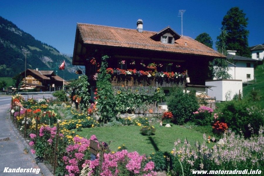
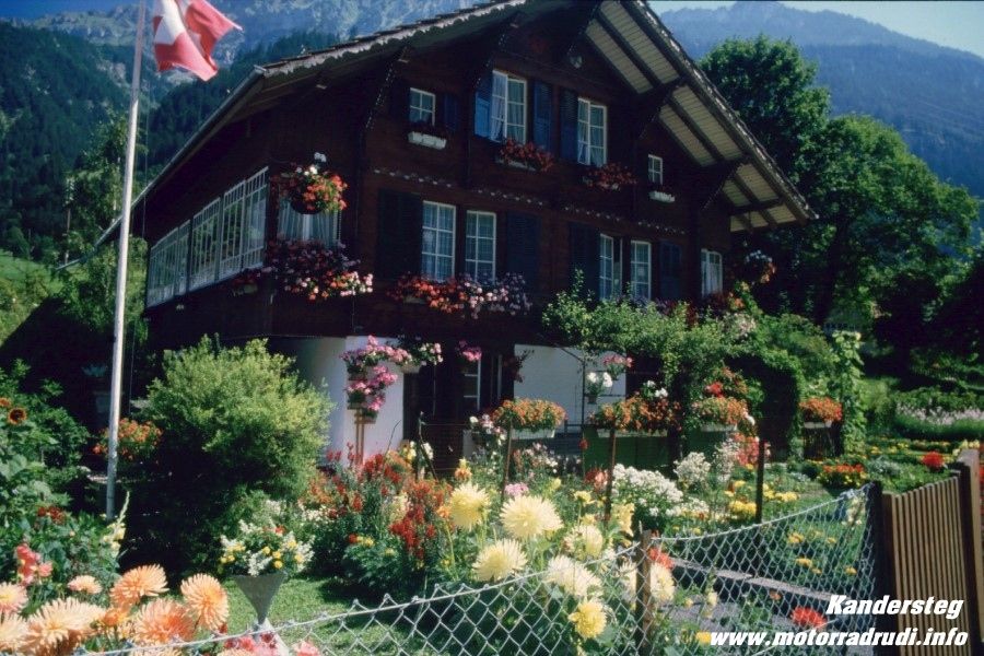
Ride Report „ 3000 km Switzerland“ 17. – 28 July, 2001
Background and Planning:
After the Big Alps-Loop of the summer of 2000, Werner, Lothar, Dietmar und I decided to have a closer look at Switzerland the following summer.
As I tend to quite often spent time in Switzerland and know my way around, we’d already been to some of the more out-of-the-way places, the quieter backwaters which are barely known, but which nevertheless offer exceptionell scenery and challenging roads.
To me, Switzerland as a whole embodies the Best the Alps have to offer and the personal highlights are:
1. The Bernese High Country
2. The Wallis (Swiss Rhone Valley)
3. The area around Lake Viewaldstaetter
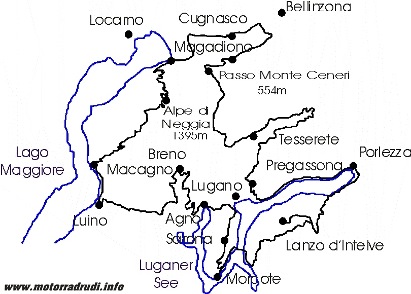
Considering those 3 key-areas, a rough plan came together easily:
· First up the area around Appenzell
· Let’s not forget Liechtenstein!
· Lake Walensee to Lake Sihlsee
· Lake Vierwaldstätter
· Bernese High Country
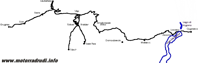
· Central-Switzerland ( Furka, Grimsel, Susten, Gotthard – resp. the old Tremola-Road!)
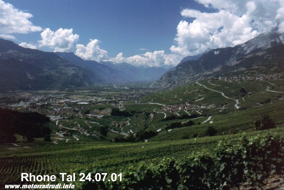
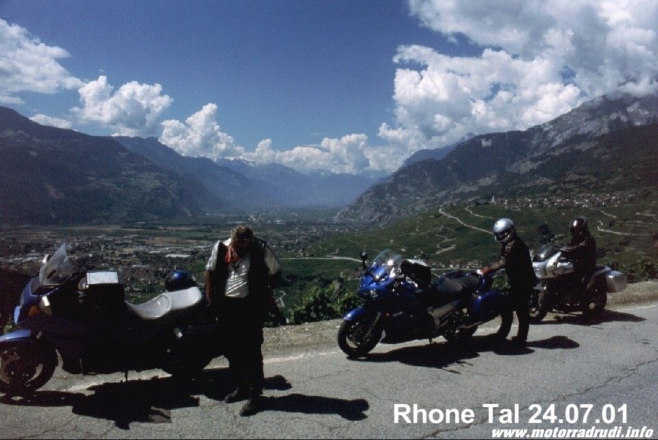
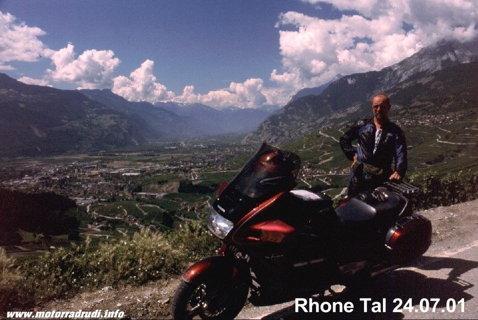
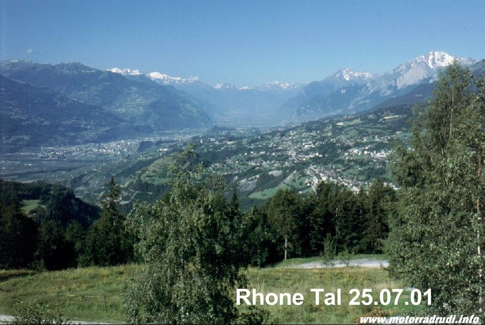
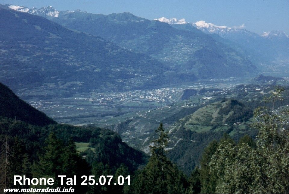
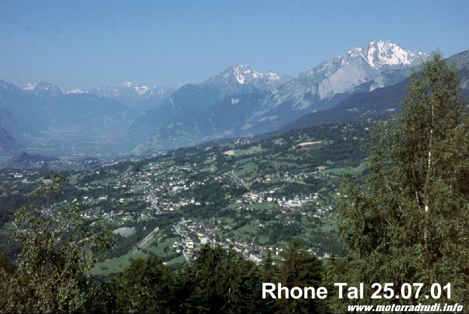
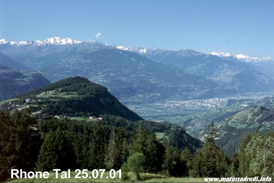
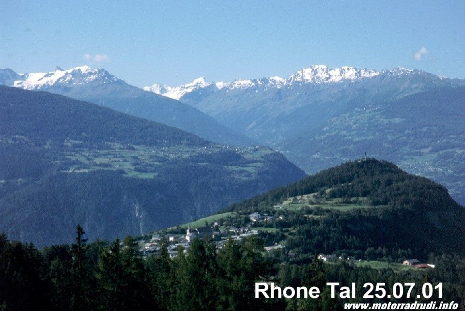
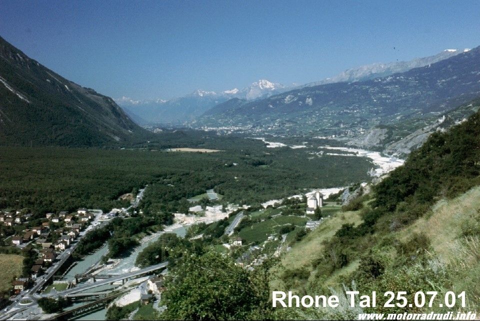
· The Rhone Valley
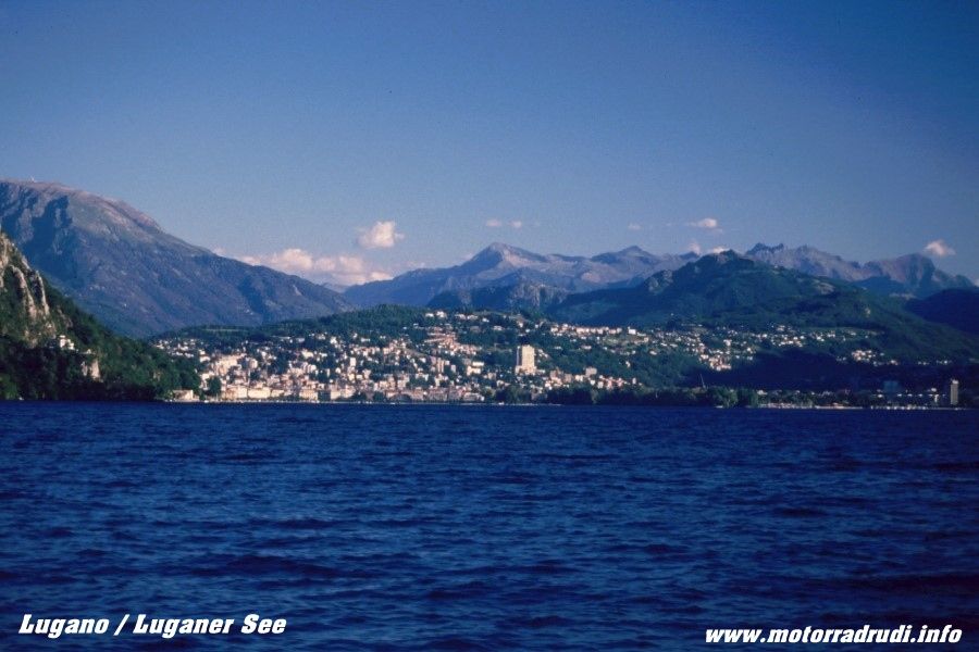
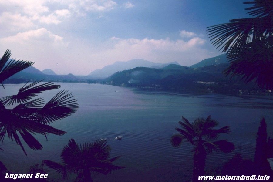
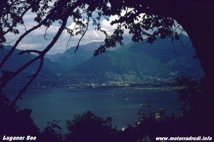
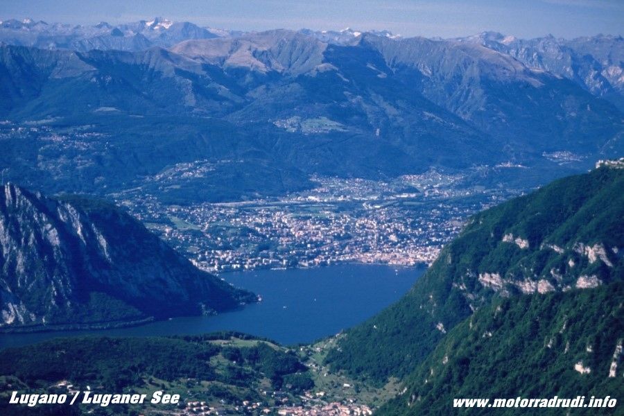
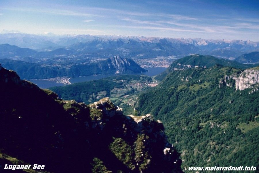
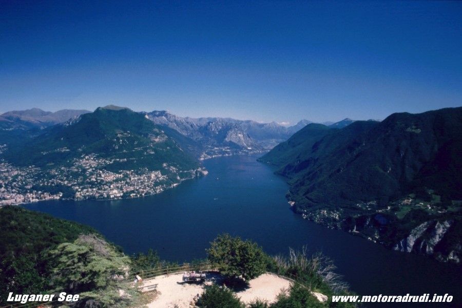
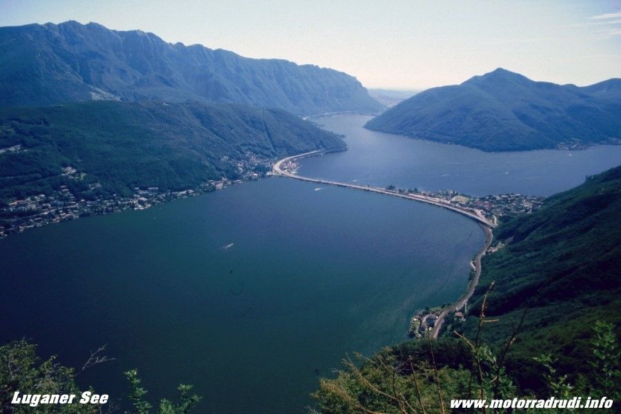
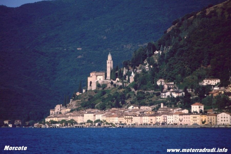
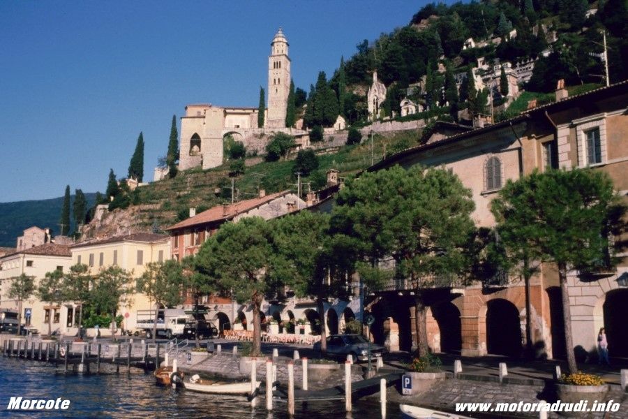
· Lago Maggiore and Lake Lugano
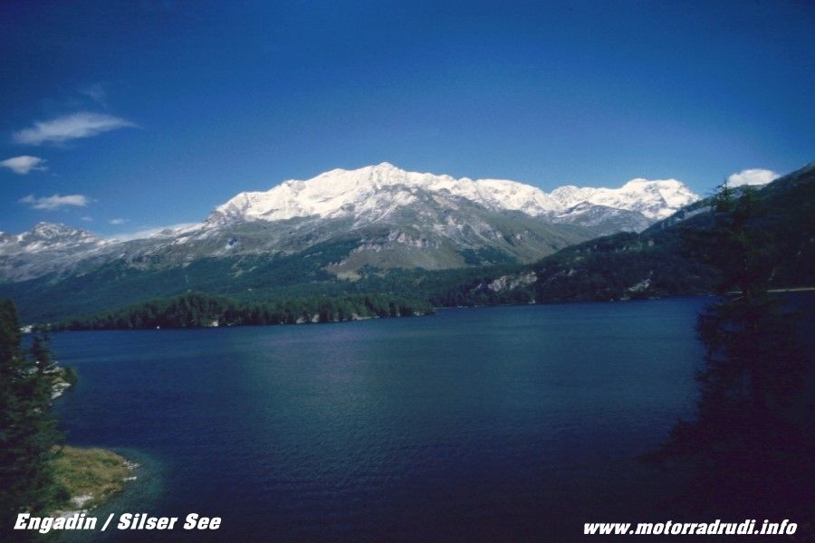
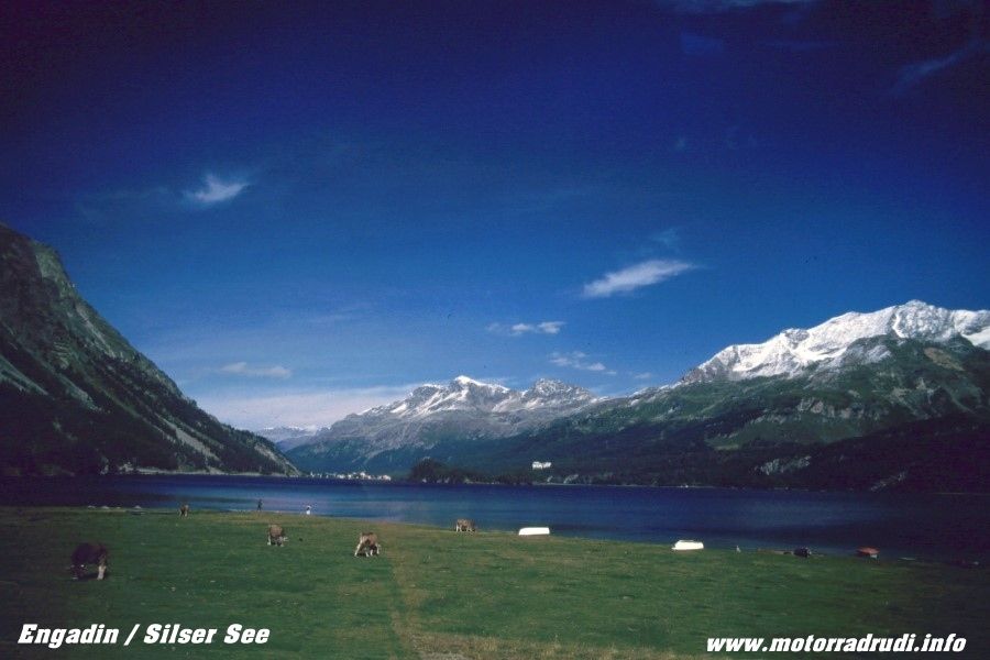
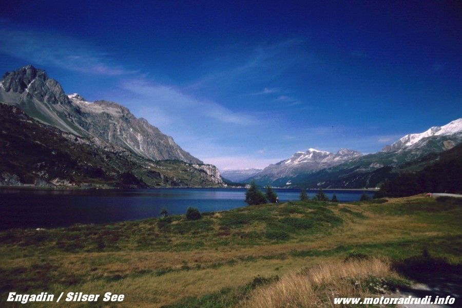
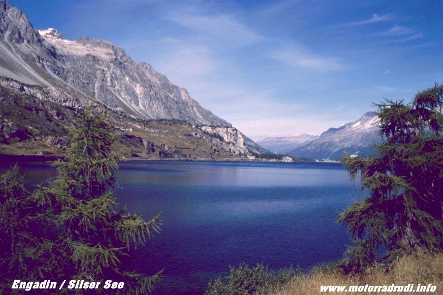
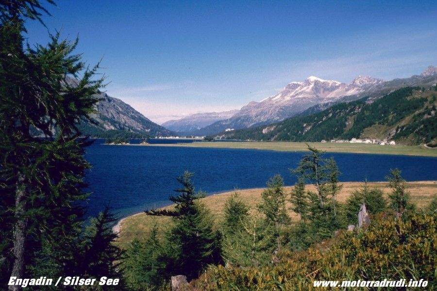
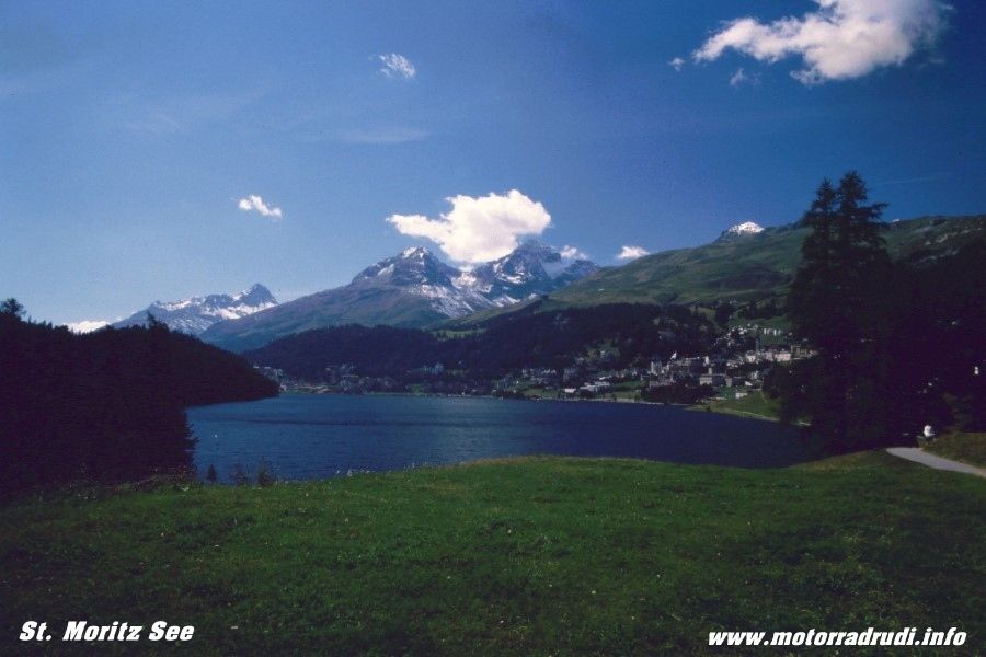
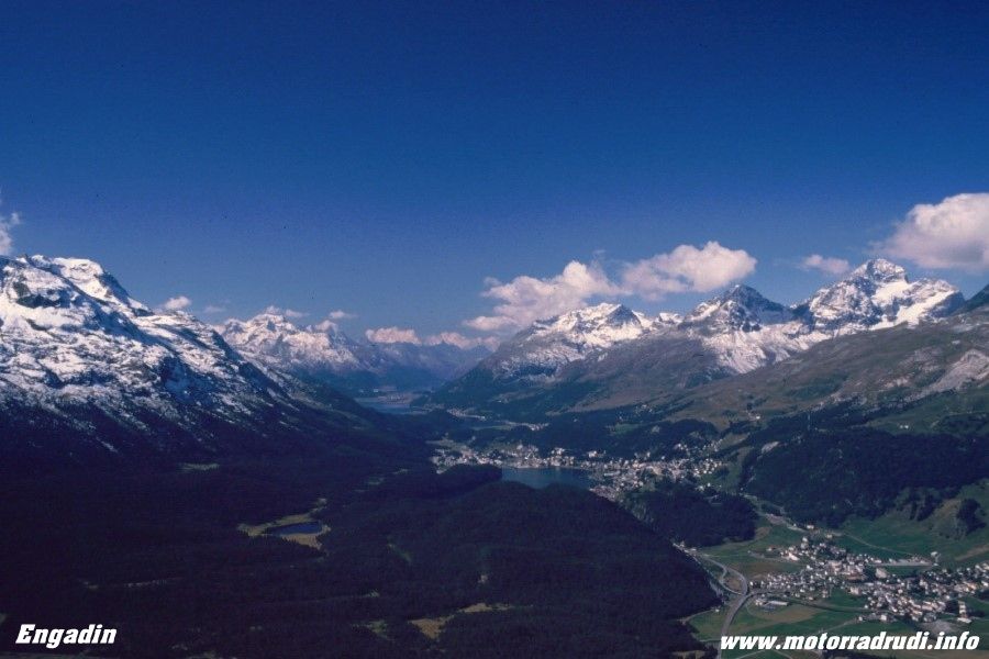
· Engadin (area around St. Moritz)
Here some impressions from this beautiful country:
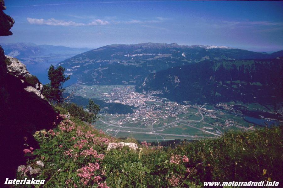
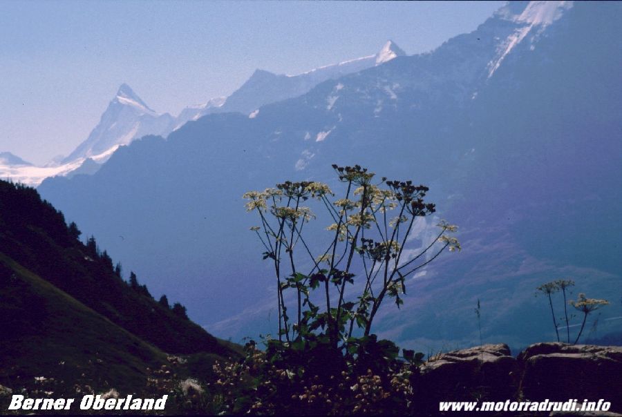
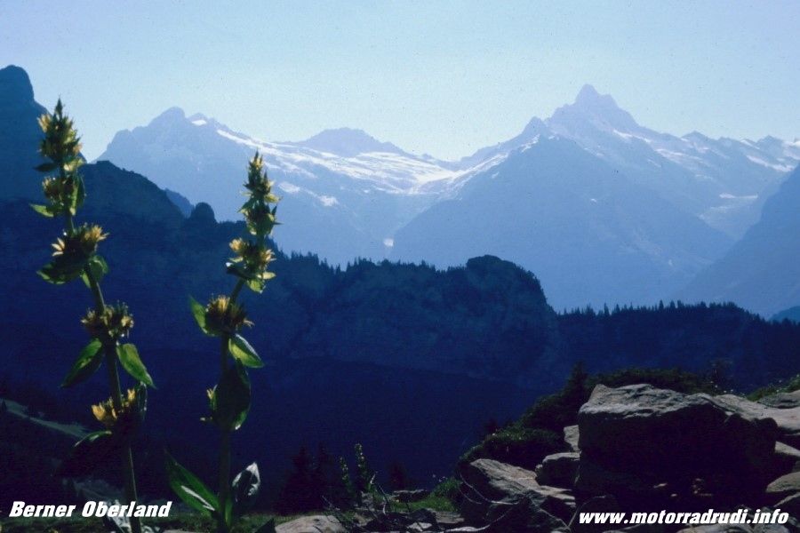
Interlaken – Bernese High Country
beautiful mountains – Bernese High Country
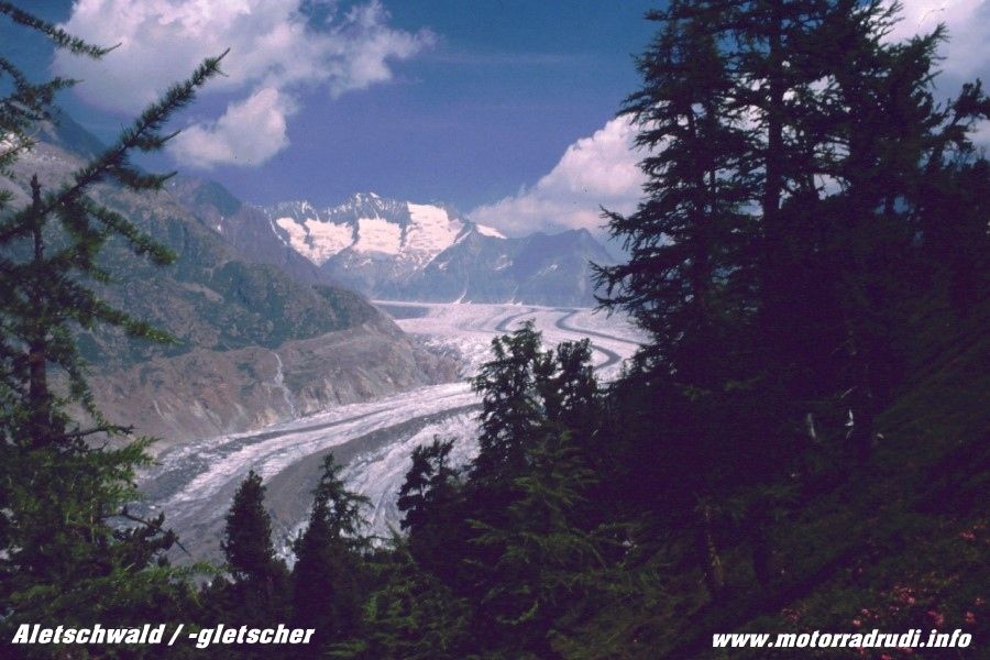
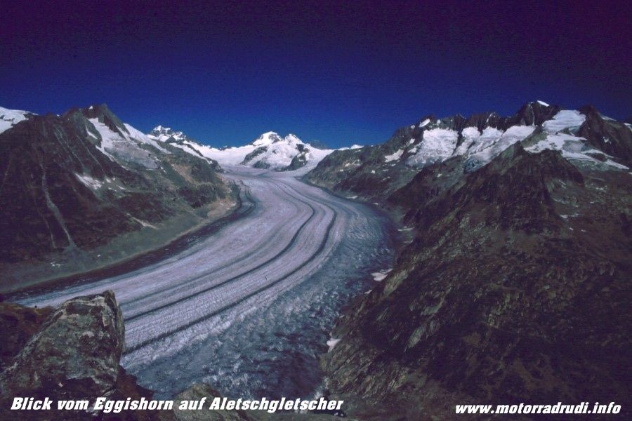
Aletsch-glacier and Aletsch-forest
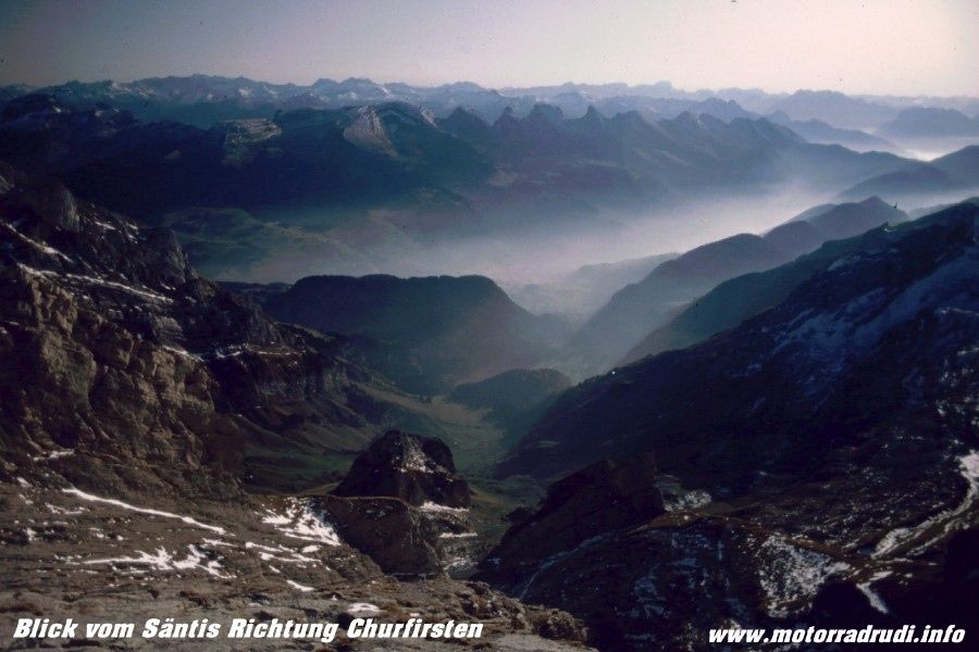
view from Säntis
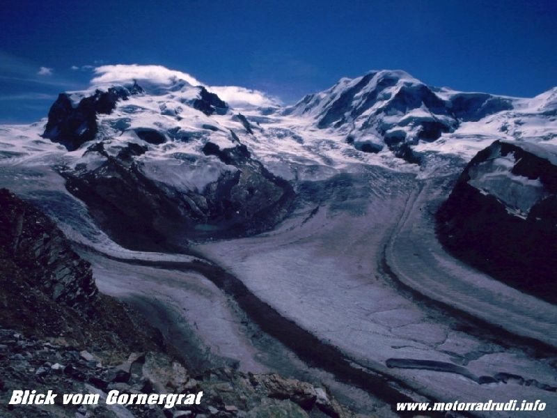
Gornergrat
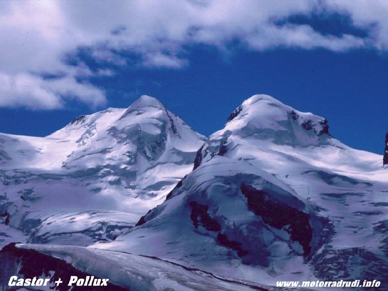
Castor und Pollux
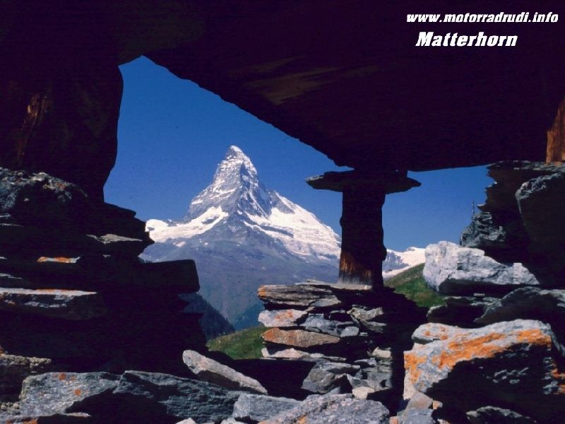
Matterhorn
After lining up our timing, we were finally off on the 17.07.01:
Tues, 17.07.01, day1:
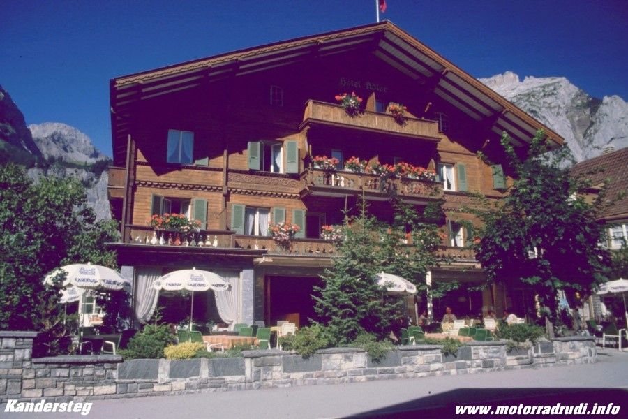
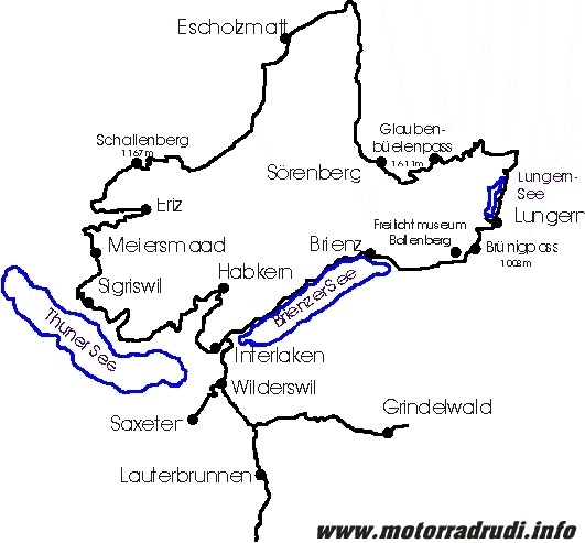
The days target was Willerzell at Lake Sihlsee, of course NOT via the direct route.
From Sonthofen via Altstädten and Fischen up the Riedbergpass (1420 m).
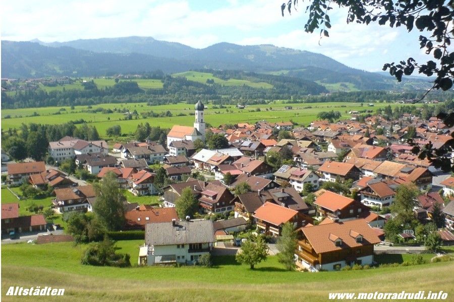
Altstädten
at the Riedbergpass
Then past Hittisau to Großegg and Schwarzenberg. Towards Dornbirn it’s first up the Bödele (1003 m), the downhiller shows Lake Constance in the distance. Crossing the Swiss border via Dornbirn and Lustenau, it’s Altstätten next, the gateway into the Appenzell-area.
This part of Switzerland consists of gentle hill-country, dotted with small villages....it all rather looks and feels like an outsized model-railway!
Roads are superb, gently sweeping up and down.
Via Oberegg to St. Anton, which (from the northern side) offers superb views across Lake Constance and down-valley views to Altstätten from the southern side.
St. Anton – view around
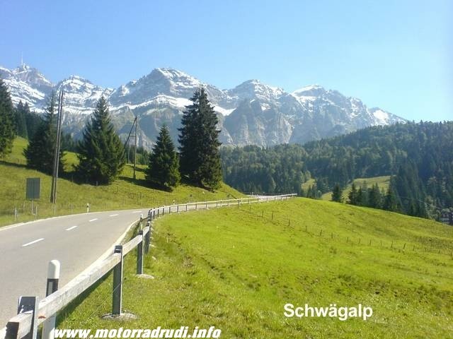
After the short stop it was across the Ruppenpass (1003 m) Appenzell and Urnäsch before the climb up to the Schwägalp (1278 m) at the foot of the Säntis Mountain.
Schwägalp
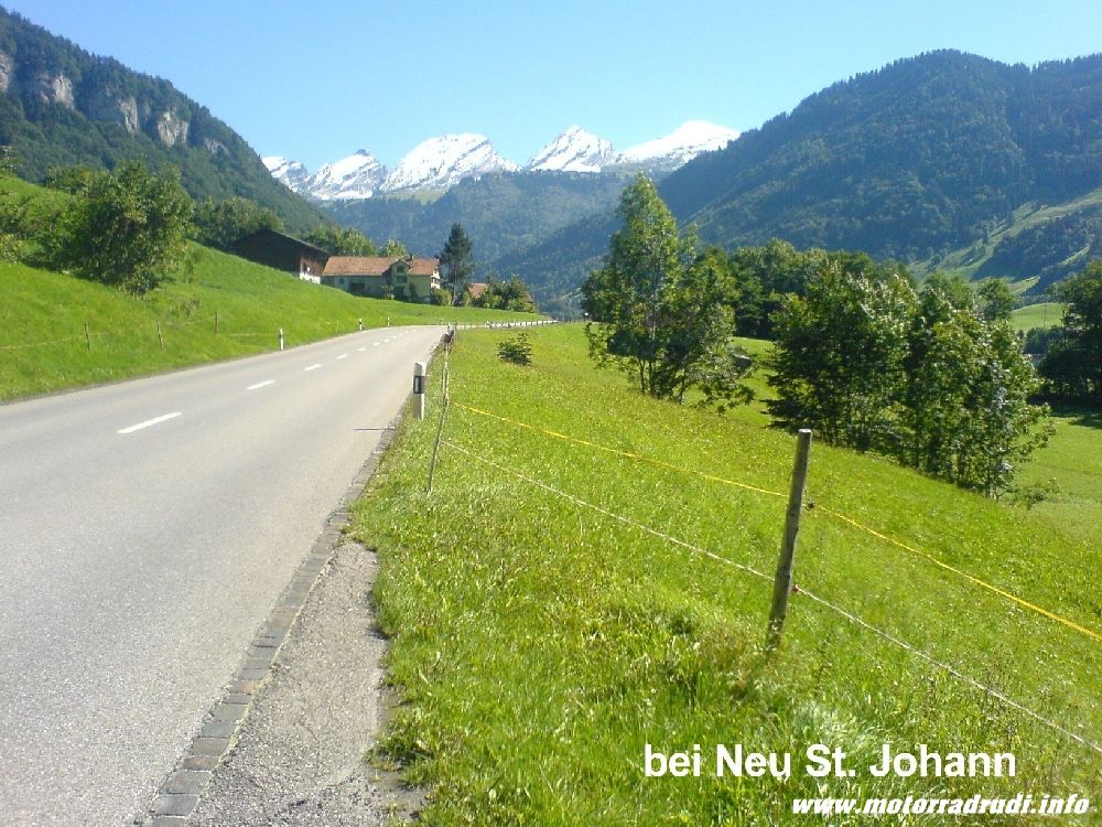
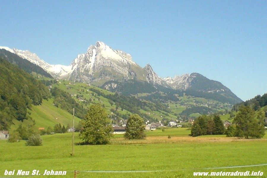
What a great road, it’s just about built for bike-riding....and things continue via Neu St. Johann and Wildhaus towards Liechtenstein.
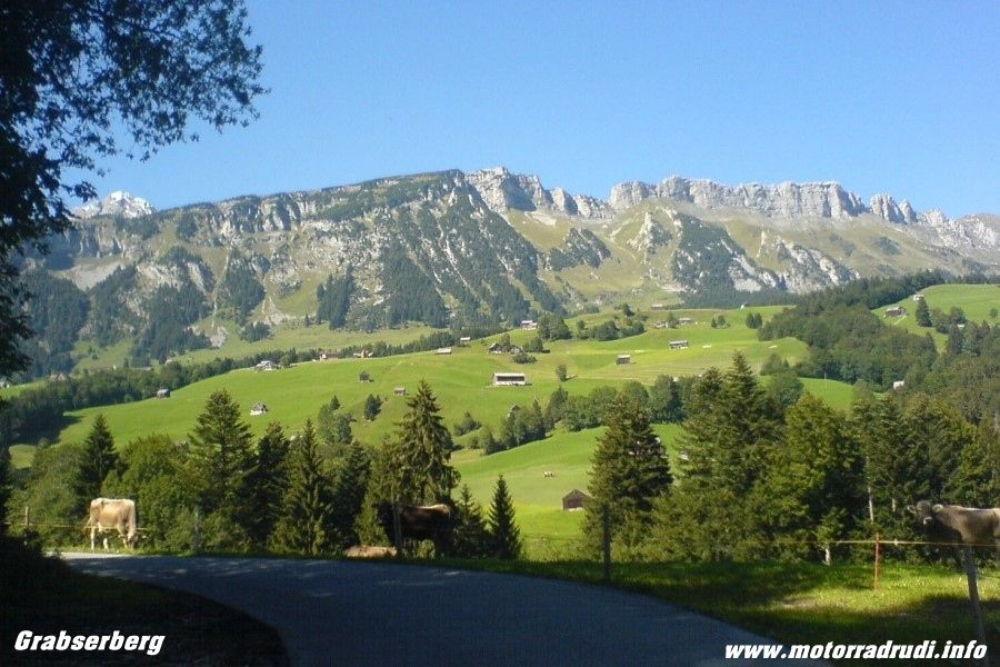
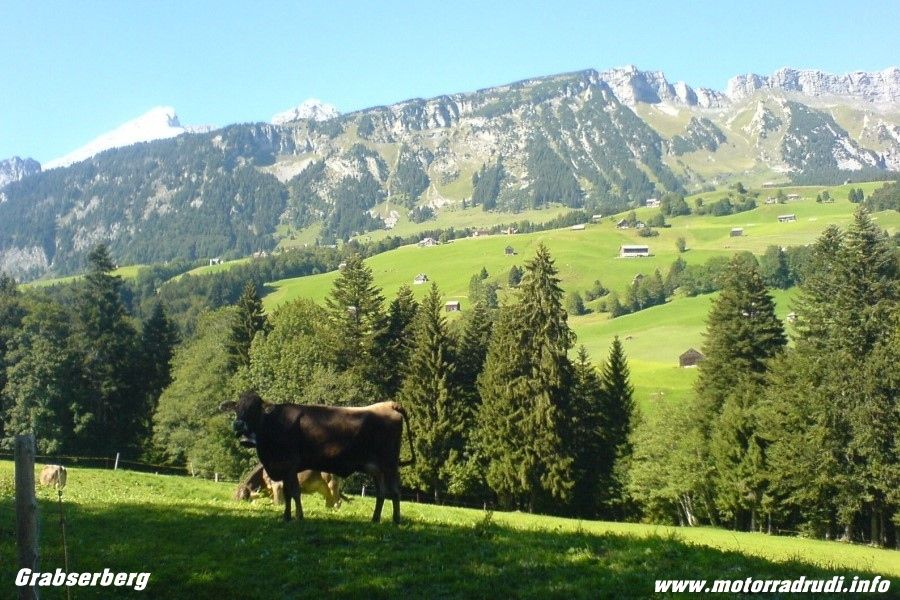
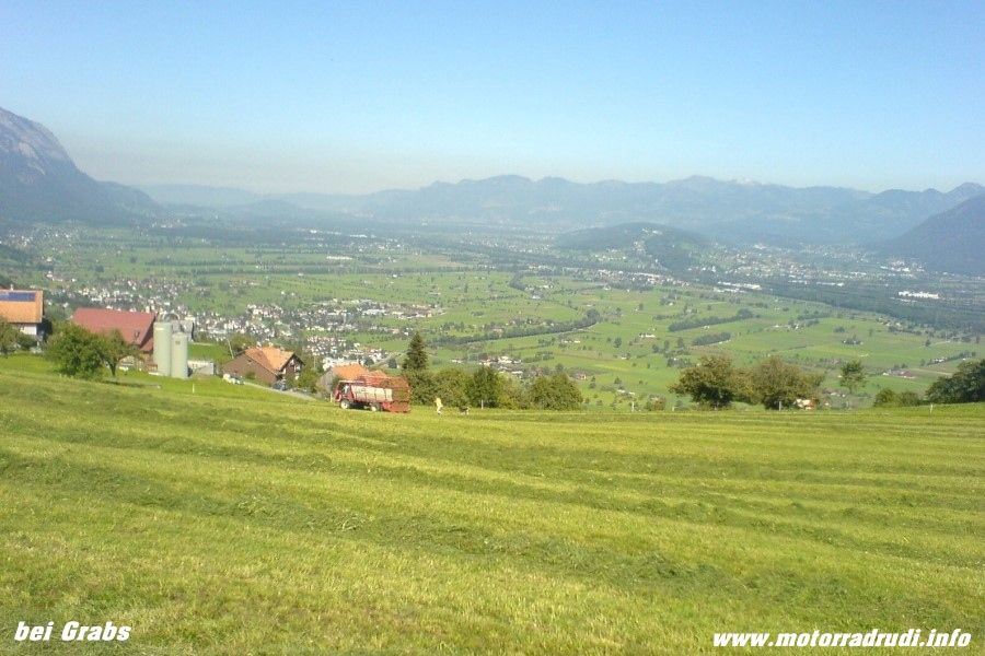
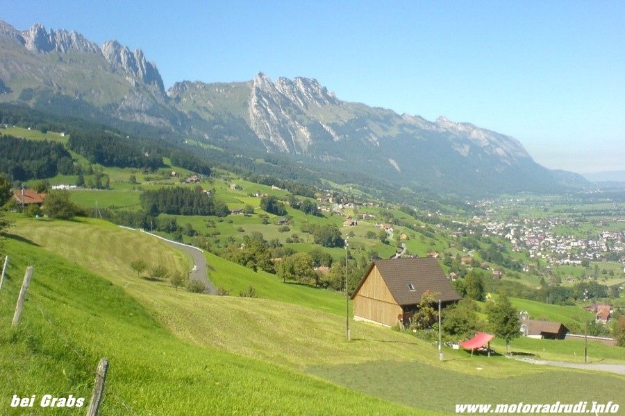
At the start of the downhill stretch, a small road turns right across Grabserberg to Grabs, offering more excellent views, one of those typical „back-roads“ that I rather prefer. To the easier and quicker main drags.
near Grabserberg
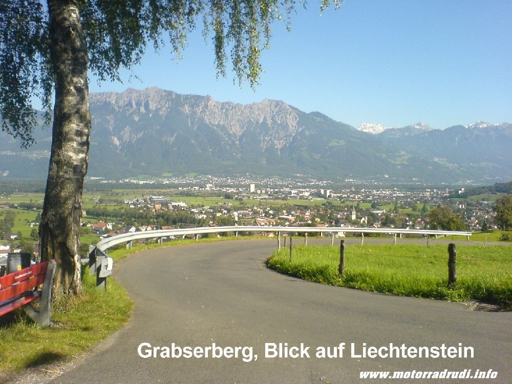
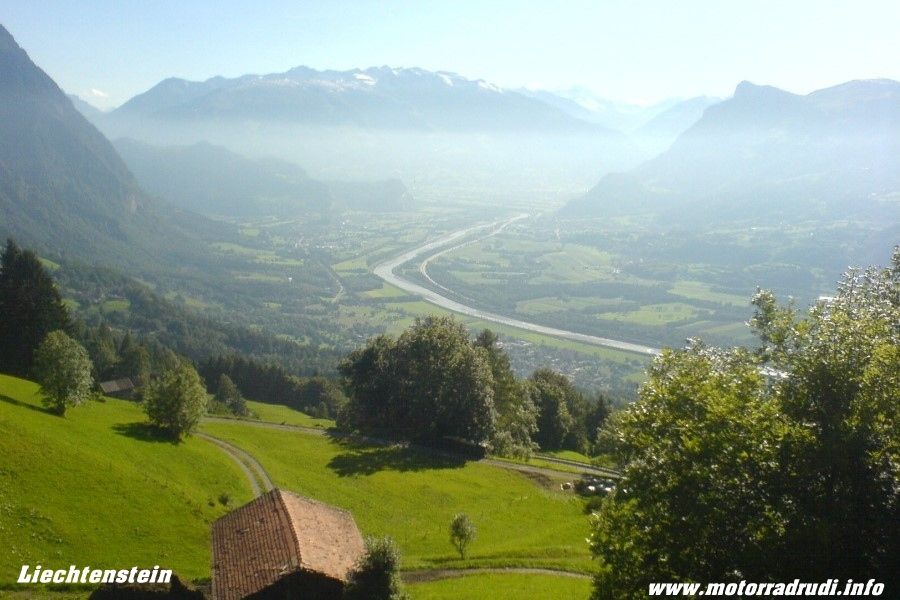
Liechtenstein came via Buchs and Schaan, the road then climbing from Vaduz to Malbun, a village in one of the furthest pockets of the tiny country. The sun put on a „light-show“, time for a quick photo-stop.
at Liechtenstein
Which included yours truly dropping the Pan European very gently onto it’s left side.
Some annoying scratches were the only damage, any more was prevented by crashbars and panniers. I still needed a little help to get her upright again though...
Despite being a dead-end, Malbun is well worth the trip, the downhill stretch paralleling the climb.
The map showed a tiny road from Mels via Portels to Flums, which somehow endet in a dead-end....doubling back, we finally found the right turn off towards Flums about halfway, a little gem of a road and decidedly preferrable to the main Sargans-Flums stretch.
From Flums to Lake Walensee, a very scenic lake cradled by high mountains, and up to Kerenzerberg (743 m) which offers magnificent views across a picture-book landscape.
Lake Walensee
Downhill to Näfels and towards Lake Zürich-See. In Siebnen it’s a left-turn up the Sattelegg-Pass (1190 m) a delight for any 2-wheeler. The Camping area in Willerzell on Lake Sihlsee was the final stop.
Sihlsee
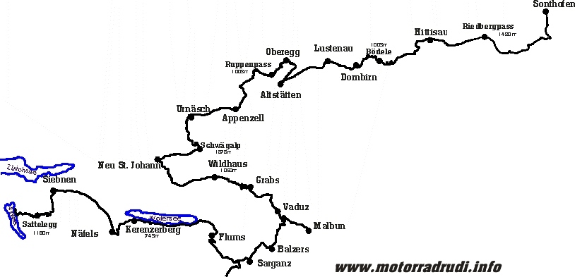
1. Day routing:
Wednesday, 18.07.01, Day2:
Well....the 2.day was planned to see us making our ways to Lake Vierwaltstätter, but the weather had other plans. Bucketing down right through the night and all morning, we decided on a stroll along the shores to Willerzell in the drizzle of the afternoon...
Thursday 19.07.01, Day3:
The rain has finally given way to a bright and sunny morning, let’s go then!
First up along the shores of Lake Sihlsees und up the Ibergeregg-Pass (1408 m).
I like it! A narrow road, but just nice to ride...sweepers up to the saddle and grand views onto Lake Vierwaldstätter, followed by more of the same along the way down to Schwyz.
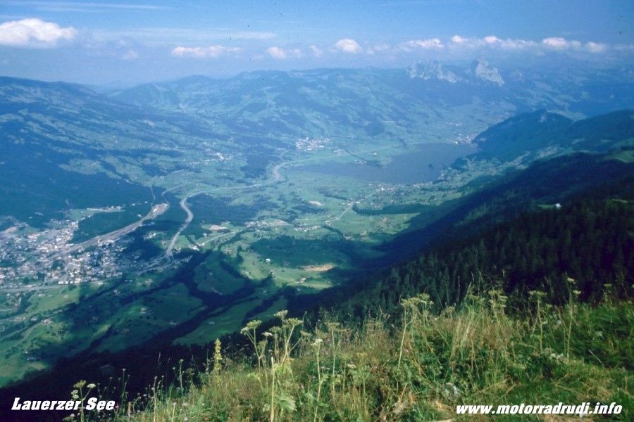
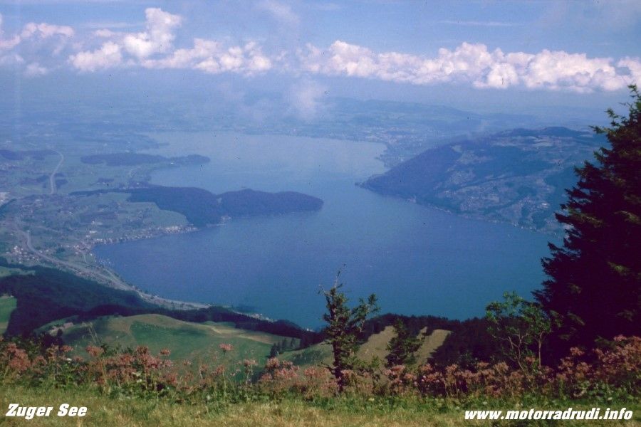
Turning west, it’s past Lake Lauerzer to Lake Zuger.
Lake Lauerzer – view from the Rigi
Lake Zuger – view from the Rigi
Looping around the north it’s on to Lake Vierwaldstätter at Küssnacht. As mentioned before, it’s one of the most scenic parts of the Alps.
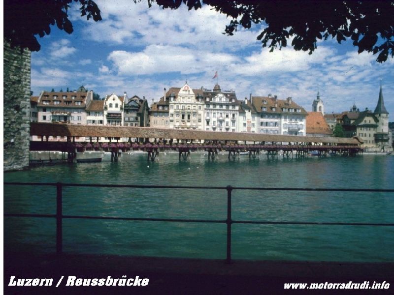
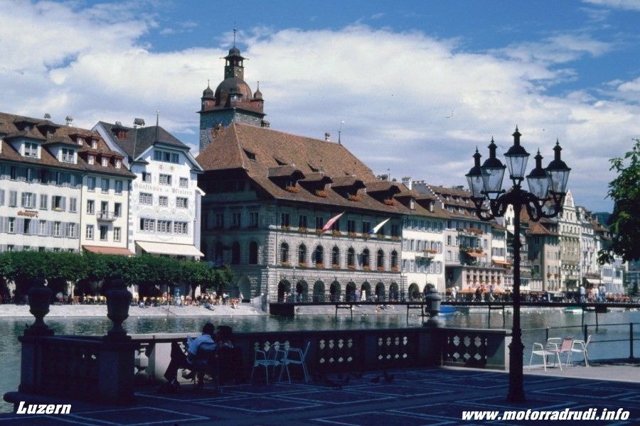
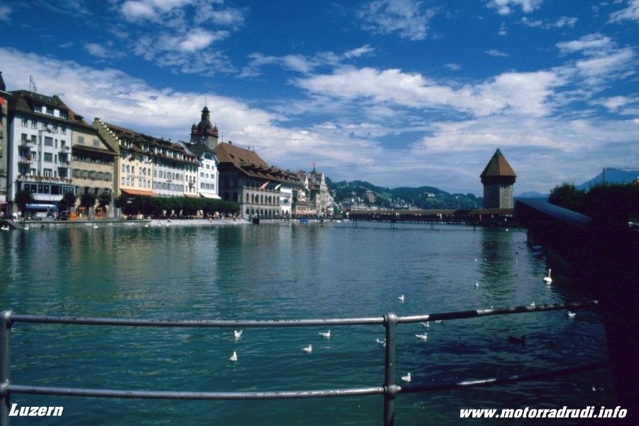
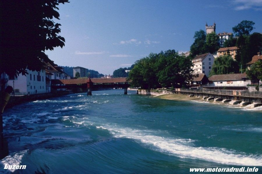
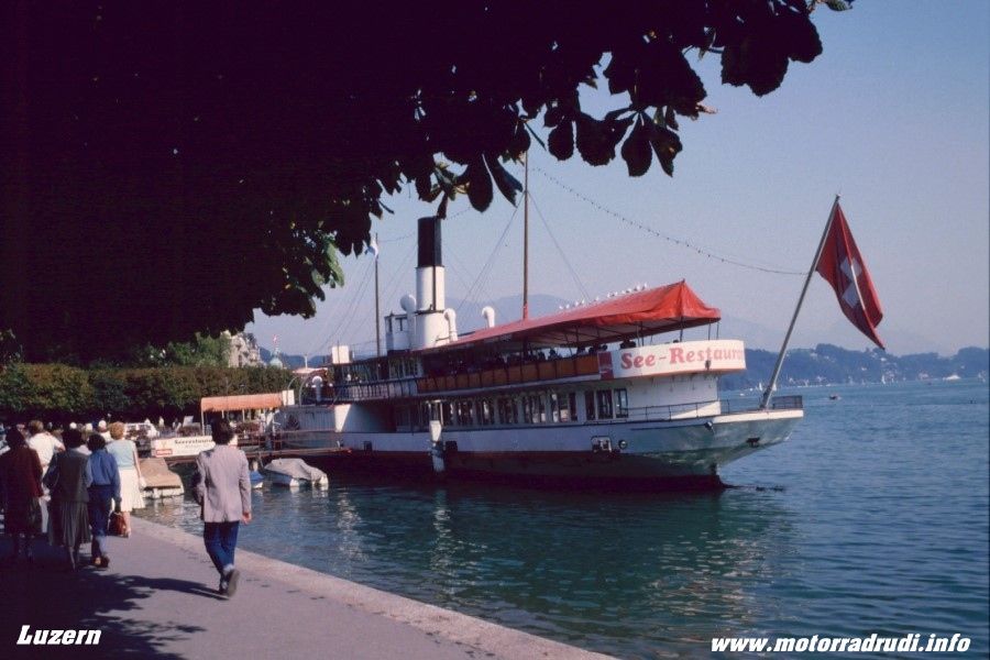
This time we took time-out for a stroll through Luzern. Always worth a visit, and not just for the old timber-bridge spanning the Reuss river, the whole town one big invite to stay and spent some time...
Luzern
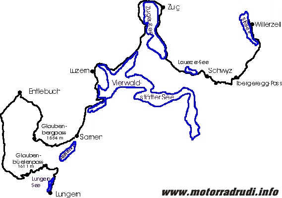
Past Horw and Stansstad and southward to Lake Sarnen. Time for another diversion, this time west up the Glaubenbergpass (1543 m).
The wide , sweeping Pass makes the climb a Waltz...and down again to Entlebuch.
From there via Schüpfheim to Sörenberg and up the last Pass of the day, the Glaubenbüelenpass (1611m).
Unlike the Glaubenbergpass, this one is rather narrow and checking for oncoming traffic is essential, despite the lower traffic volume.
Lake Sarnen
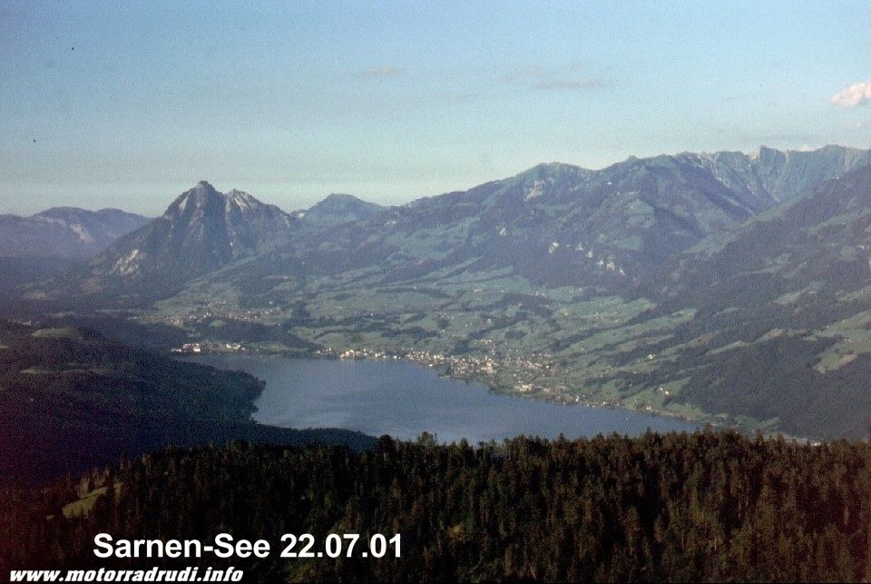
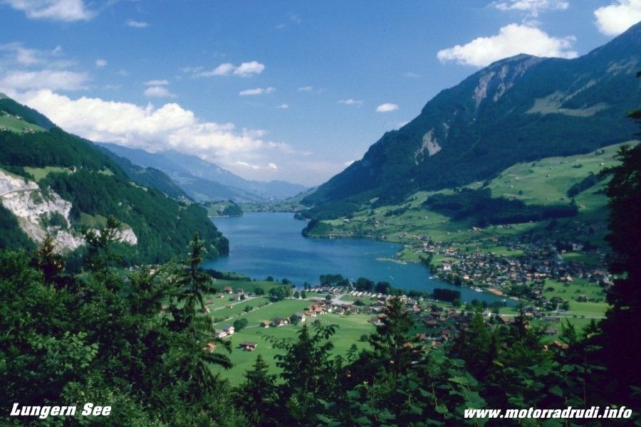
Down to Lake Sarnen, the views are exquisite. Another short stretch to our target, Lake Lungern. Dietmar proved again, that he hadn’t lost any of his Chef’s skills. Tents up, feet up....life’s good !
3. Day routing:
Friday, 20.07.01, Day4
Another day of solid rain....but laughs were still had hanging around town and camp.
Saturday, 21.07.01, Day 5. :
Finally the sun’s out again, time to move on.
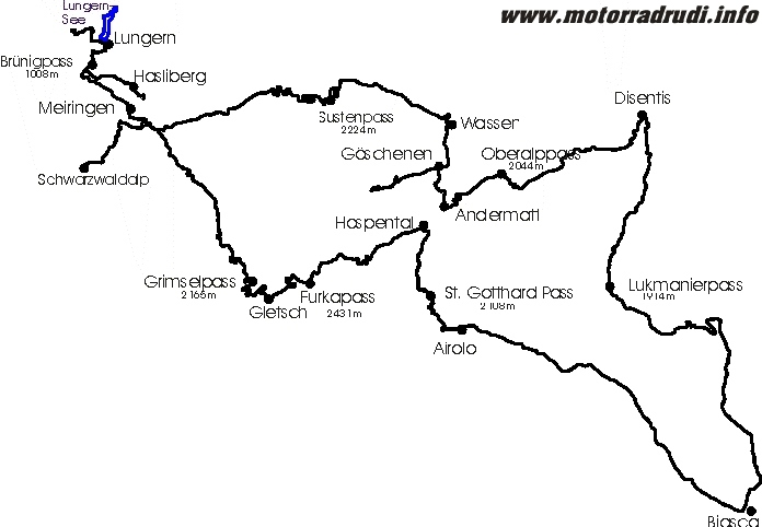
A 9am start saw us moving towards Central Switzerland with its famous passes of
Susten-, Grimsel- and Furka…one can NEVER get enough of those, but this time adding Oberalp-, Lukmanier- and the St. Gotthardpass… to be exact, the old Tremola-Road!
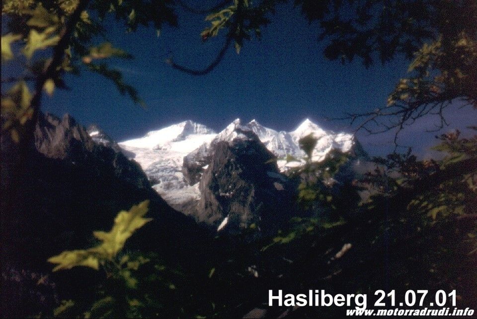
From across the Brünigpass (1008 m) to Hasliberg. It’s a dead-end, but well worth it for the views into the Bernese High Country.
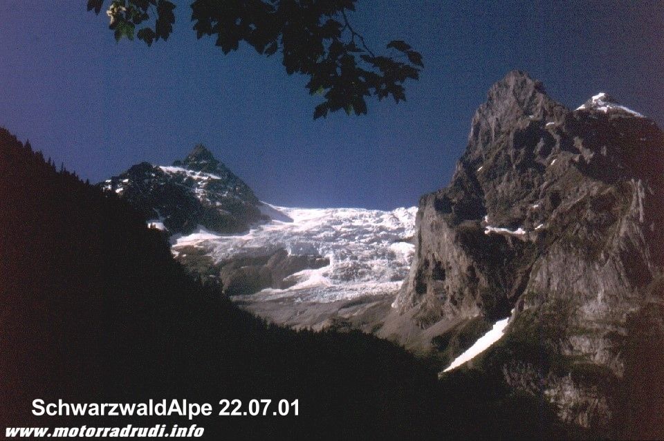
From Meiringen to the Schwarzwaldalp, from here a road leads across the Grosse Scheidegg to Grindelwald, but the road is only open for local coach traffic.
No regrets though….as now the time has come for some serious pass-scratching.
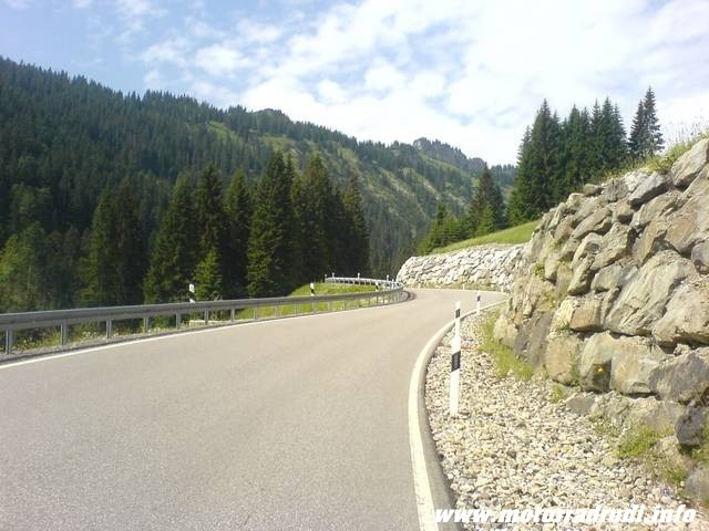
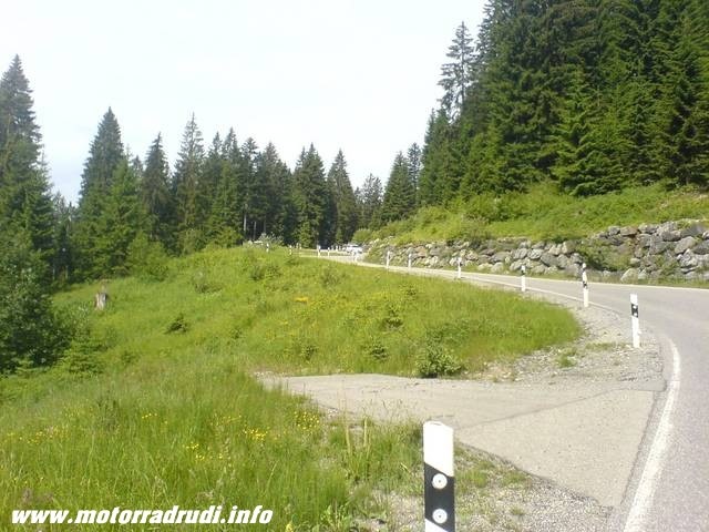
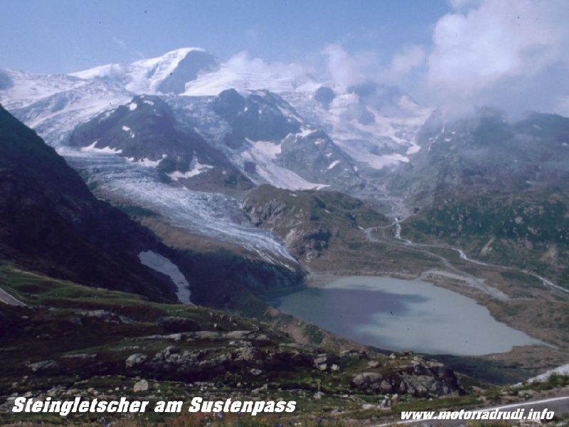
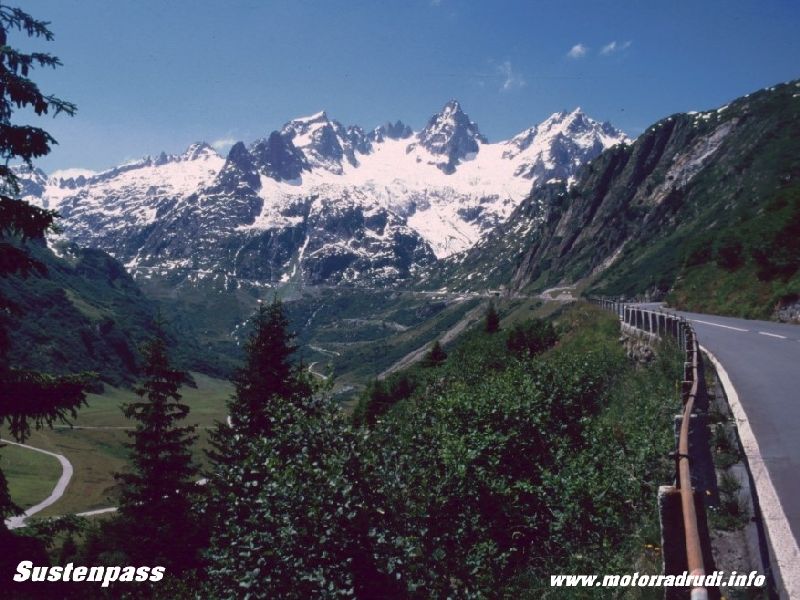
Up the Sustenpass, 2224 m, past Stein Glacier – the customary stop – and up to the top. The Sustenpass, like all other passes of Central Switherland, is a riders DREAM:
Perfect roads, incredible scenery and a million bends...it’s a never-ending smaorgasboard for the senses.
Sustenpass - stoneglacier
Sustenpass
Down to Wassen, then climbing towards Andermatt. A short side-trip from Göschenen into the Göschenen Valley and the Göscheneralpsee. Completely removed from the tourist-routes, the brain is on overload, the panoramas stunning.
Back to Göschenen and on to Andermatt the next „2k“ pass is close:
The Oberalppass (2044 m) drops into the Upper Rhein Valley, leading from Disentis to Chur. More bends, more views, more perfect bends.... Via Disentis onto the Lukmanierpass, with 1914 m just shy of the „2k“ mark.
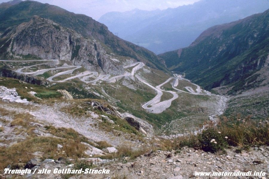
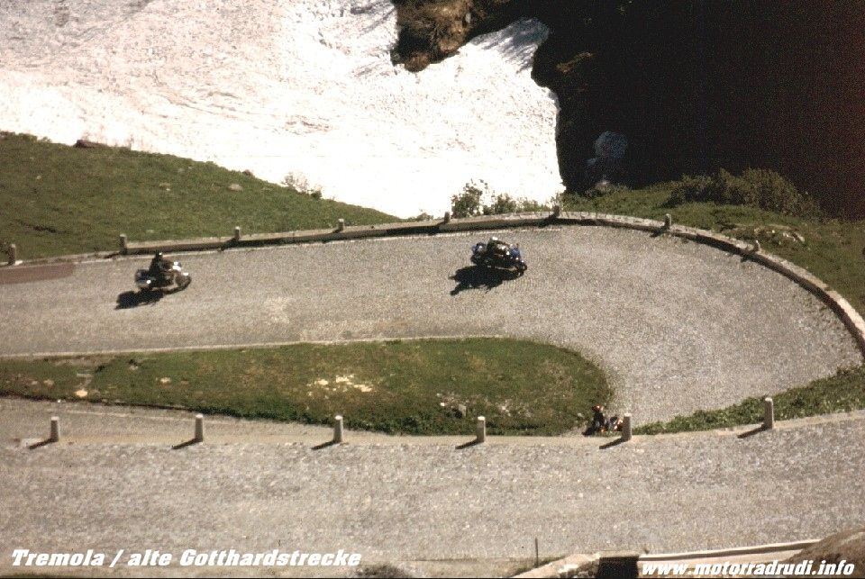
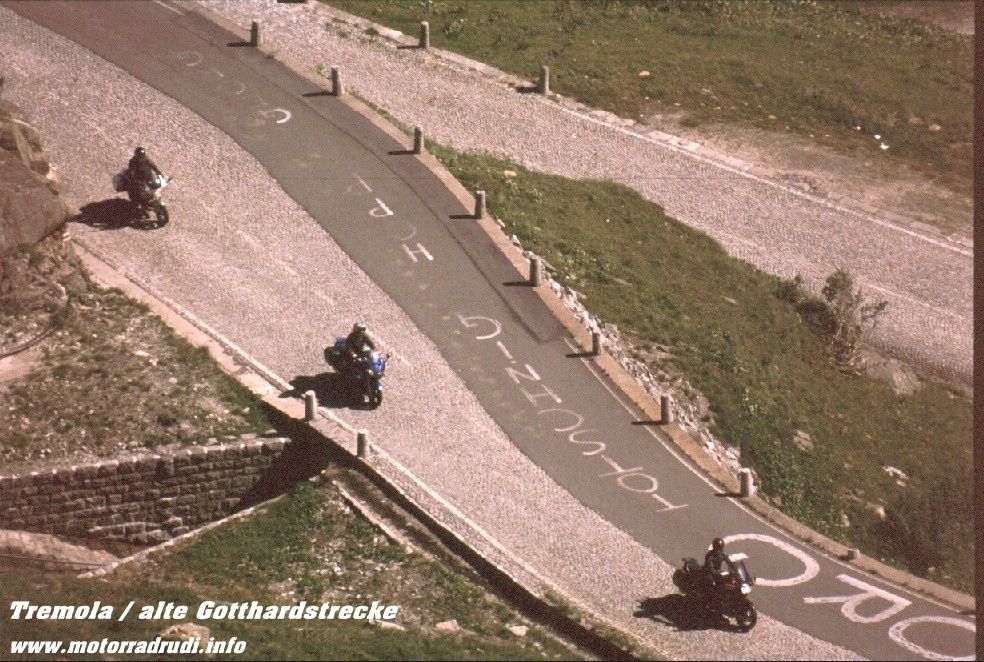
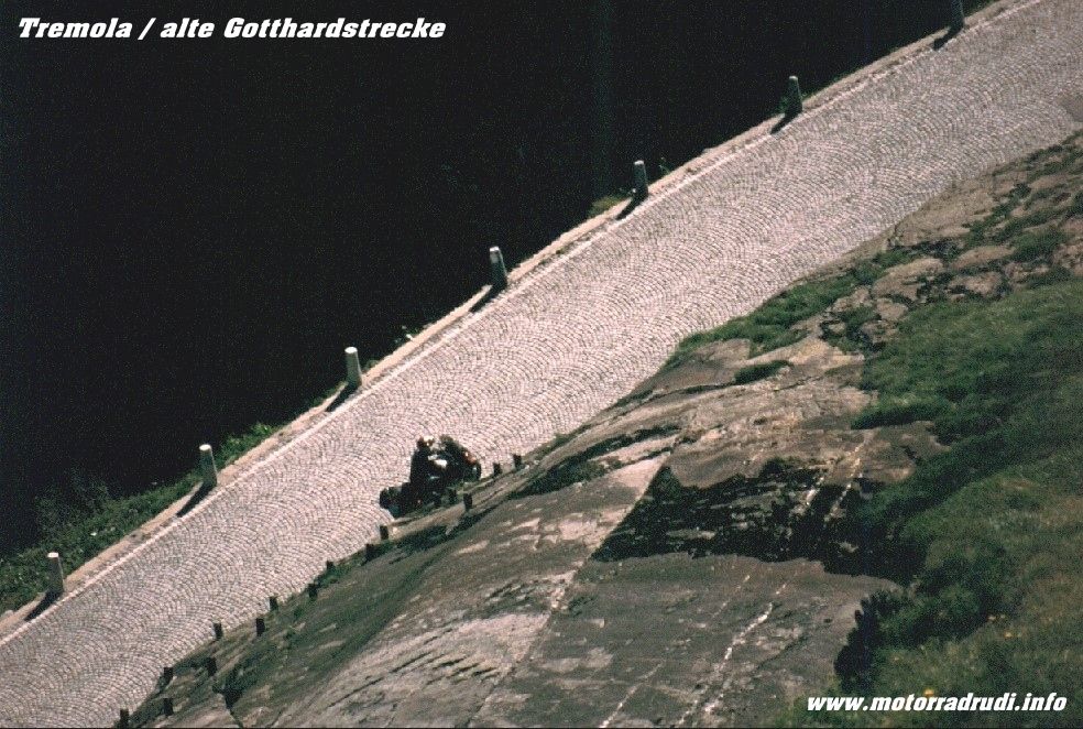
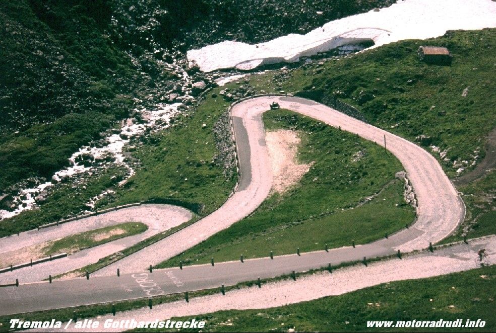
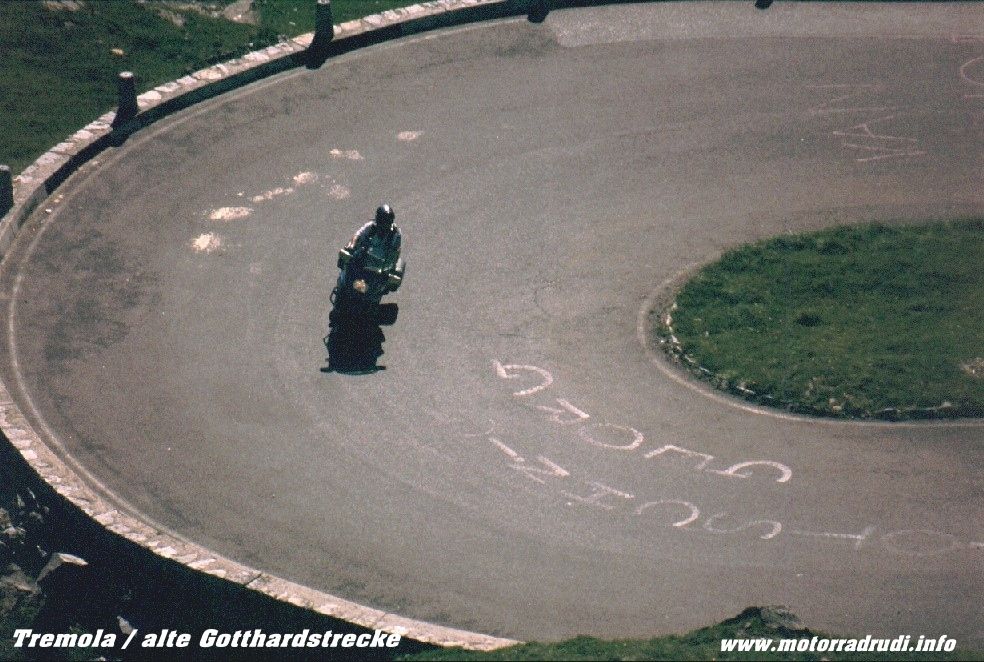
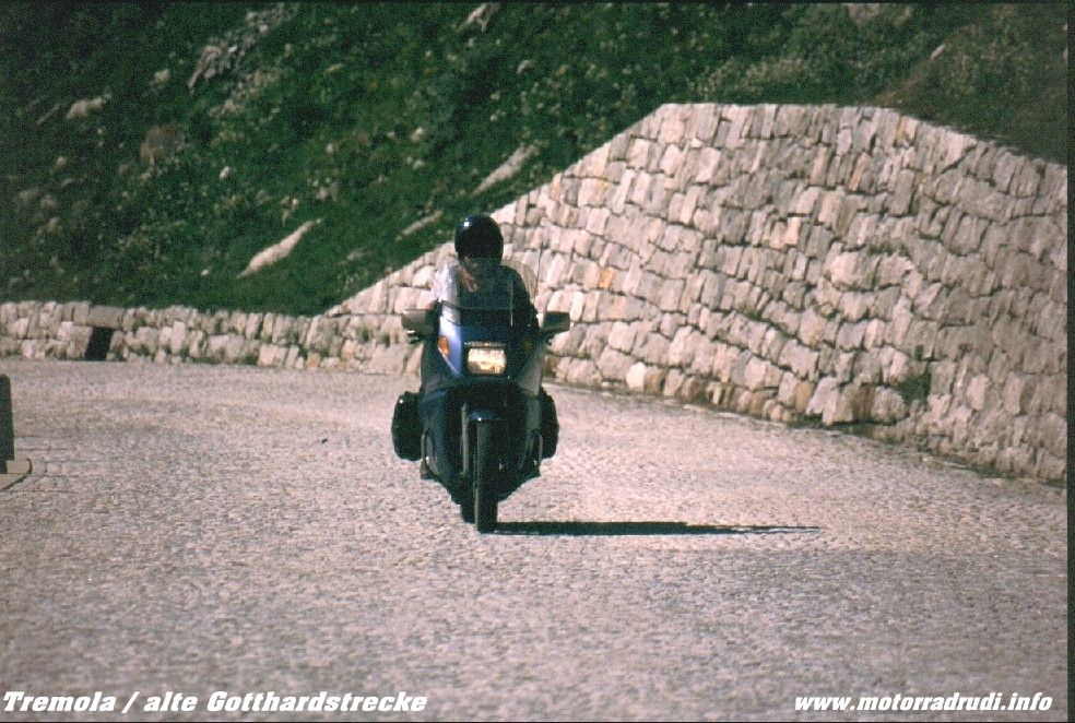
Despite that...the riding-dream continues towards Biasca, then direction Airolo. Here, the old Tremola-Road climbs up the St. Gotthardpass (2108 m). The old (now by-passed) pass-road still has it’s sections of cobblestone paving... despite it’s bumpiness and treacherous character when wet, it’s an absolute MUST if in the area.
Tremola (the old St. Gotthard-route)
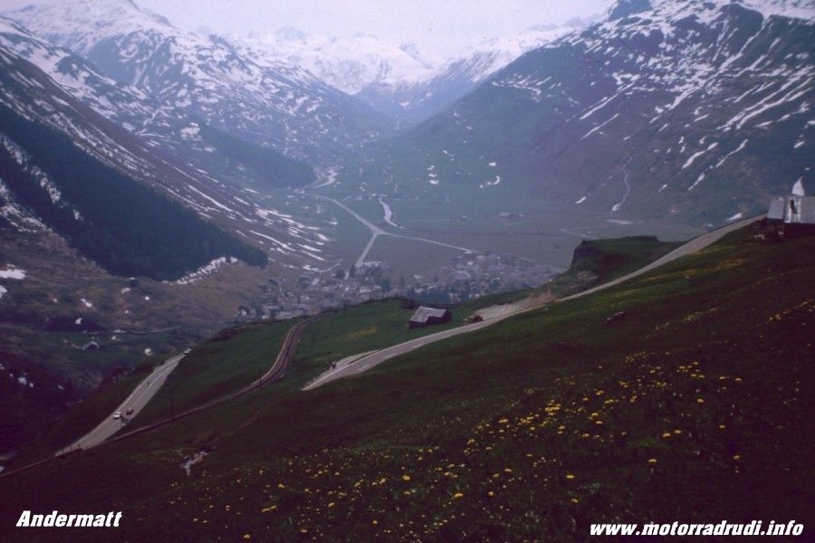
Andermatt
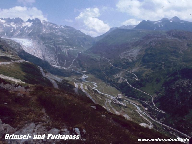
Descending the other side into Hospental it’s a short turn west to climb the next ‚Biggie“, the Furkapass, 2431 m, the undisputed highlight of the day.
Unlike the other passes of Central Switzerland, the road is rather narrow and one has to keep a constant eye on traffic.
Magic bends and sweepers lead to the top, the descent passes close to the mouth of the Rhone Glacier, which, as most other glaciers of the Alps, is receding more and more, year by year. Still, it’s a very impressive sight.
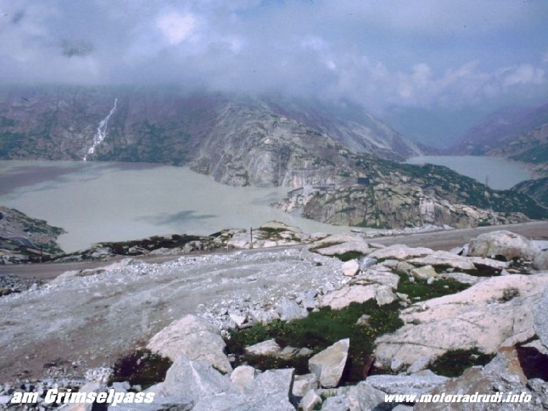
Rolling into Gletsch the dream wasn’t over yet. One more ‚2k“ for the day... the Grimselpass (2165 m), again offering everything, that makes a rider’s dream:
Superb road, superb views...and bends, bends, bends with little traffic.
Grimselpass – view to the Rhoneglacier
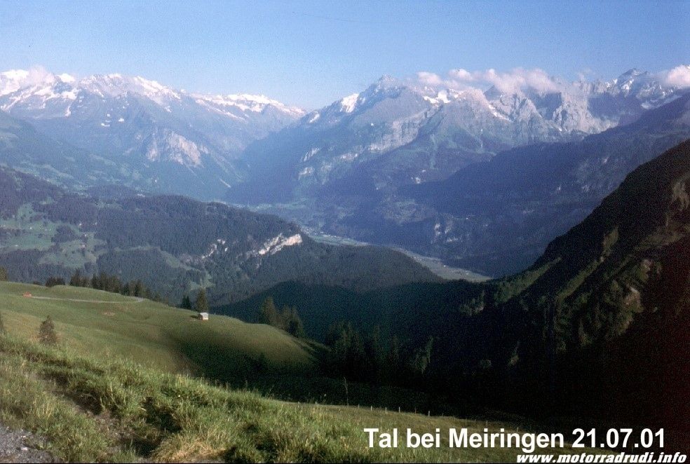
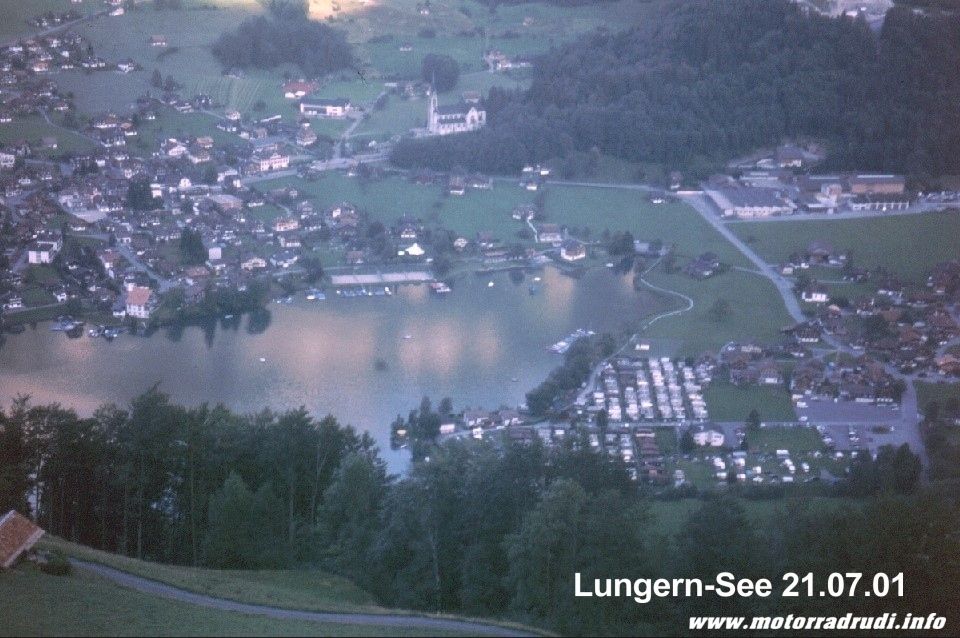
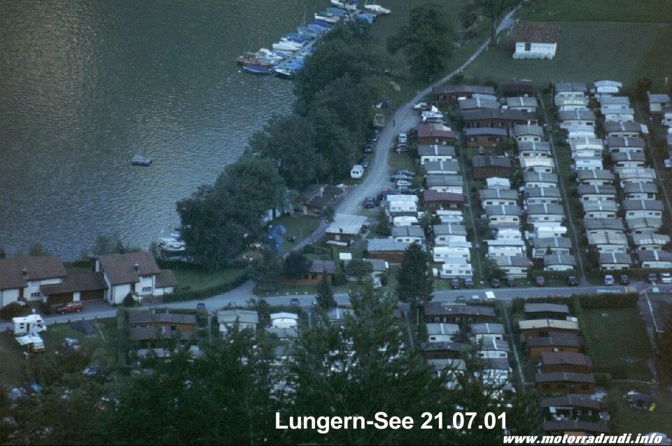
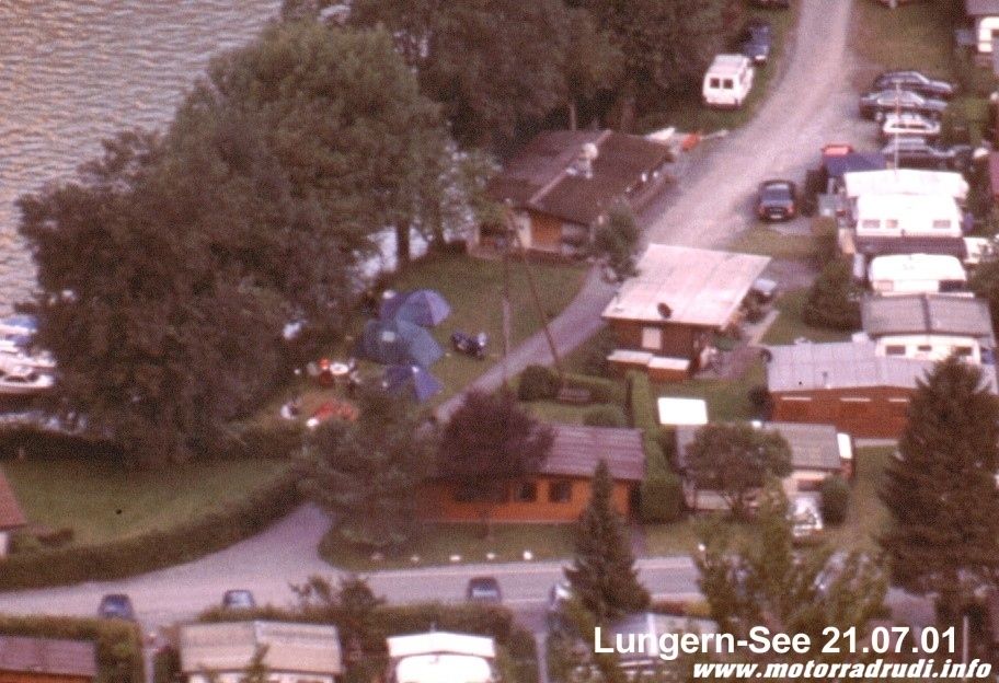
Past Lake Grimsel and Lake Räterichsboden towards Meiringen. From here, a quick hop across the Brünigpass (1008 m) back to Lungern.
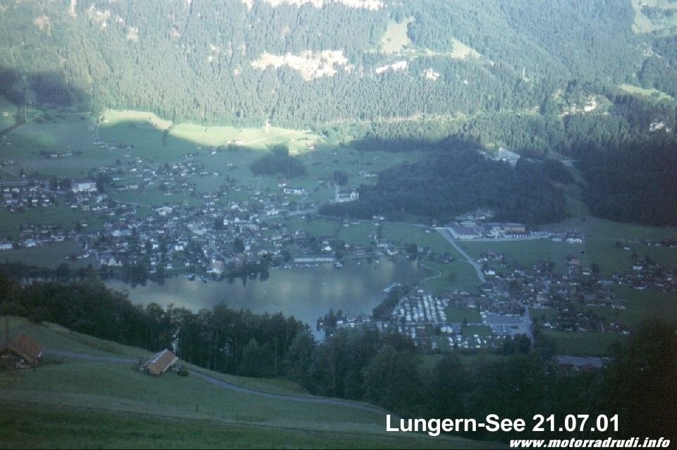
Lake Lungern
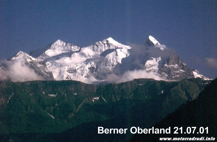
While the other 3 had enough after a full-day-rollercoaster, I’d discovered a tiny road leading up the hill from the campsite...climbing 1000m over 10km. The reward was a fantastic view into the Meiringen Valley and the Bernese Ice-giants in the distance, a well-worth effort crowned by another Dietmar dinner-delight.
Lake Lungern
5. Day routing:
Sunday, 22.07.01, Day 6. :
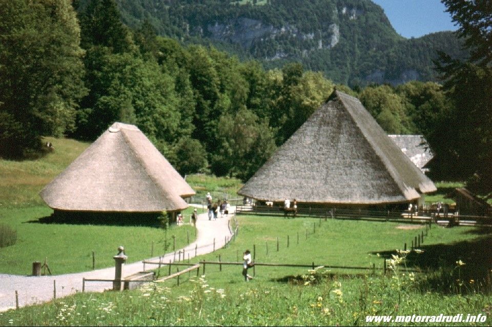
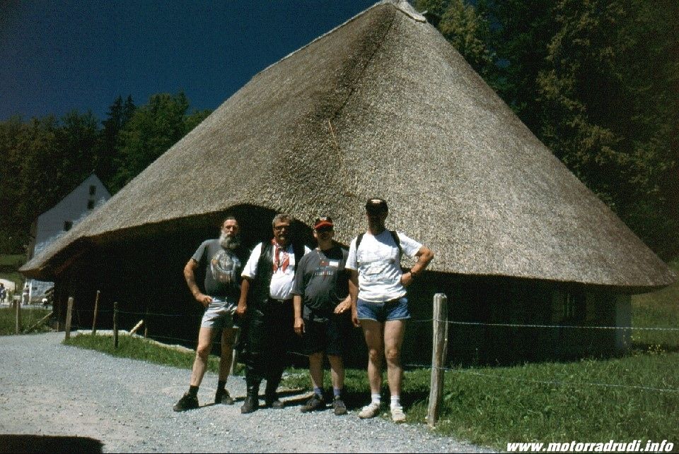
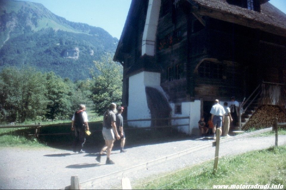
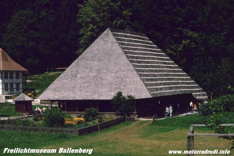
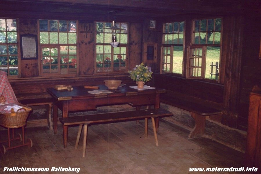
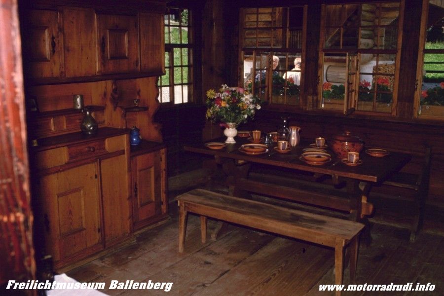
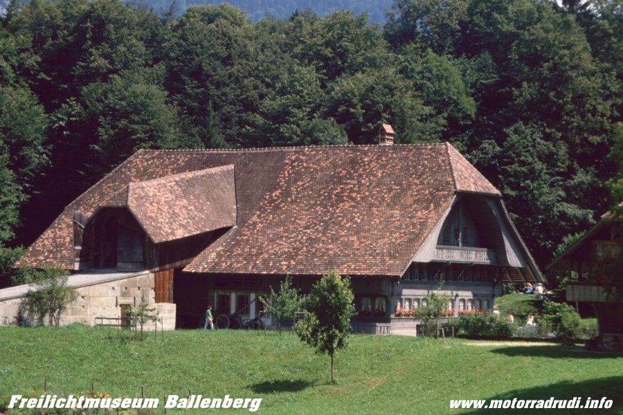
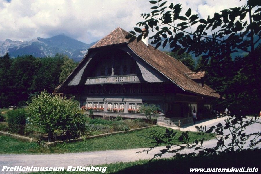
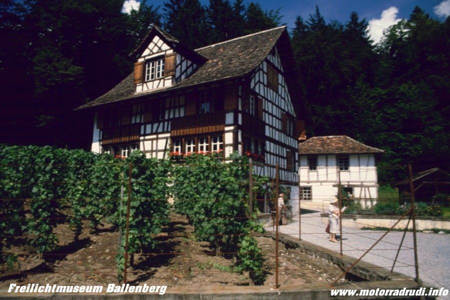
Under blue skies it was up the Brünig-Pass (1008 m) for another one of those things “not-to-be-missed”: the open-air museum at Ballenberg.
Integrated into the surrounds and crowned by mountain ranges, it’s a collection of buildings showing off the different building styles found within Switzerland, a worthwhile visit!
Count on spending around 3-4hrs…my 3 travelling mates were just as impressed as myself, even though I’d been there before.
open-air museum Ballenberg
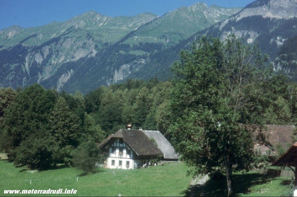
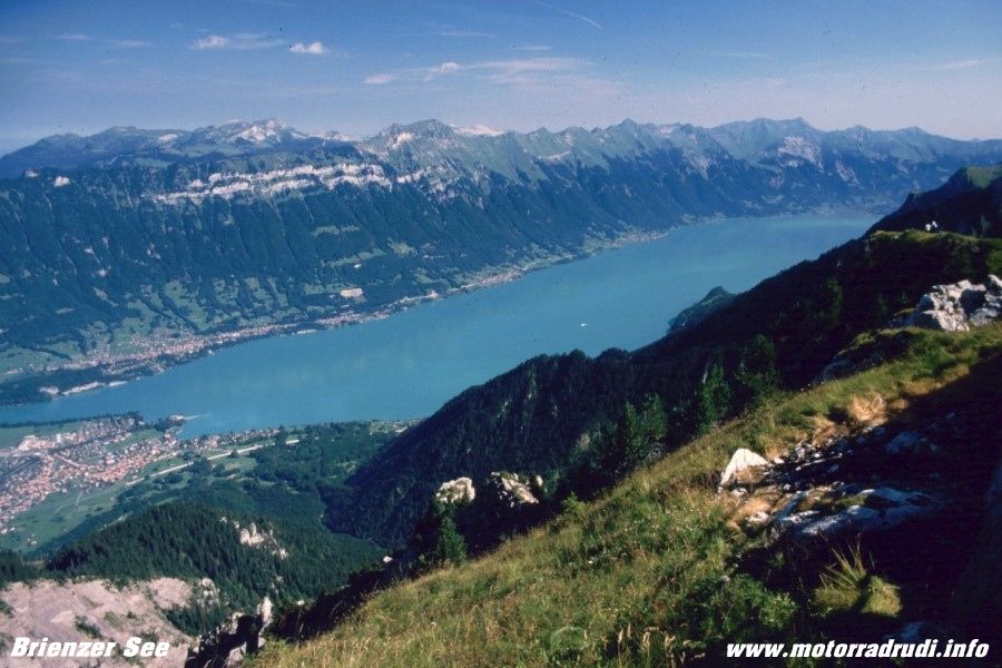
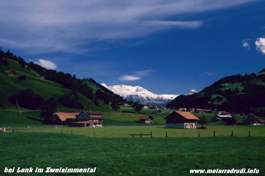
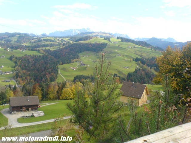
The afternoon brought us into the Bernese High Country, which, I reckon, is the most picturesque part of the whole Alps region. STUNNING !!!!!
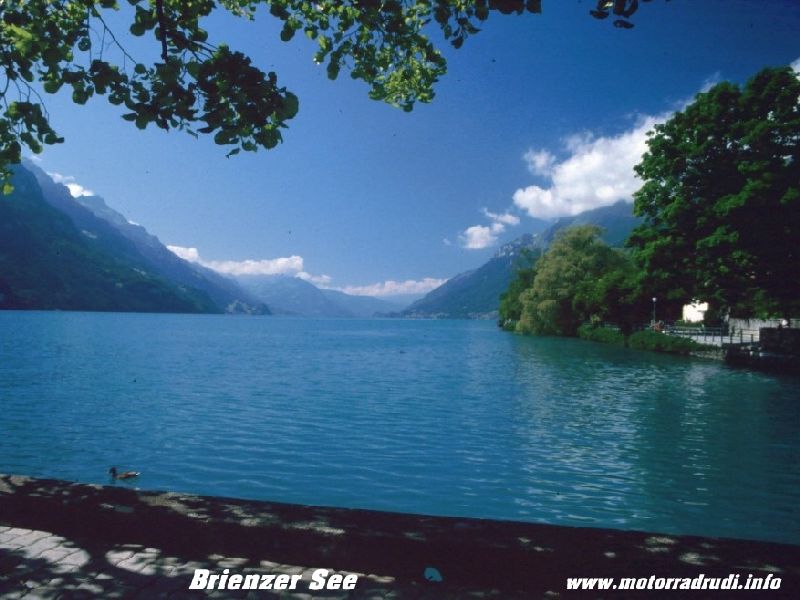
Along the shores of Lake Brienzer to Interlaken and Wilderswil.
Lake Brienz
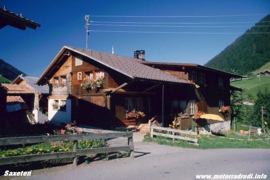
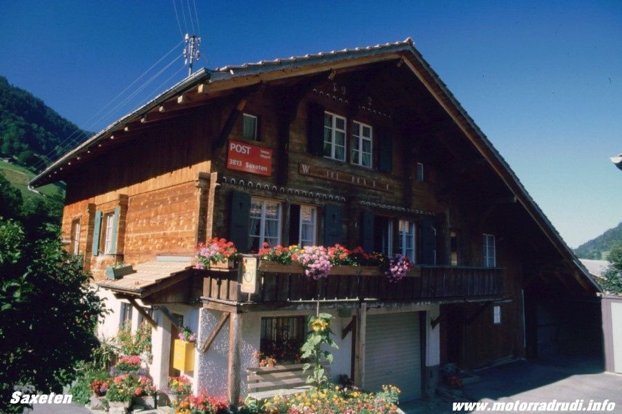
Then the narrow road up to Saxeten, escaping into tranquillity above the hustle and bustle of Interlaken, Lauterbrunnen and Grindelwald. It’s a small, picturesque village with beautiful buildings and a superb pub offering lunch.
Saxeten
Back down into the valley and through Grindelwald to the mouth of the Grindelwald Glacier, an imposing sight, where the road meets up with the one taken from Schwarzwaldalp yesterday (the one only open for local coach traffic).
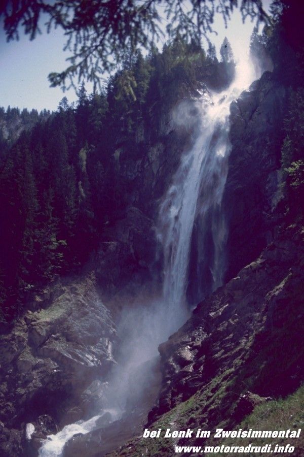
From Grindelwald via Lauterbrunnen to Stechelberg. At Lauterbrunnen awaits another natural attraction: the Staubbachfall, a waterfall plunging 300m into the valley.
Towards Stechelberg are the Trümmelbachwasserfälle, a series of 10 glacier-fed waterfalls inside the mountain face, accessed by a tunnel-lift.
But there were other highlights waiting…back to Interlaken and up to Habkern.
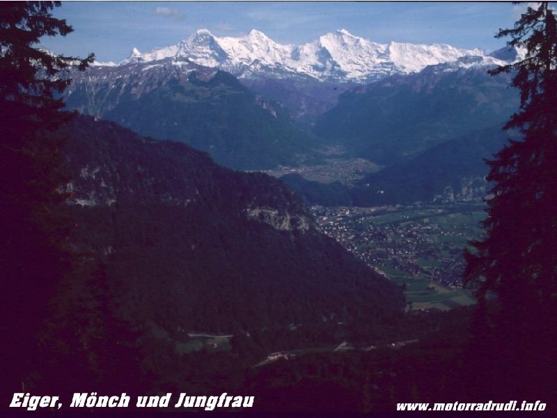
The road looks like leading nowhere, but turning left in the last hairpin before the village, the small toll-road leads to Waldegg and Beatenberg, offering breathtaking views of the “Holy Triple” of the Bernese alps: Eiger, Mönch and Jungfrau, the 3 ice giants.
Eiger, Mönch and Jungfrau
Easy to see the attraction to climbers from all over the world.
From Beatenberg another small toll-road leads through various tunnels to Sigriswill, offering brilliant views onto Lake Thun below and most of the Bernese High Country above.
The map showed another small road from Sigriswill via Maiersmaad, Horrenbach and Eriz onto the Schallenberg Pass road, the landscape turning into the total opposite…gentle green hills, shallow valleys…roads turn from bends to sweepers.
Sort of like Scotland…and the narrow road showed little traffic.
Across the Schallenberg (1167 m) and through Escholzmatt across the
Glaubenbüelenpass (1611 m) again back to ‘base-camp” at Lake Lungern.
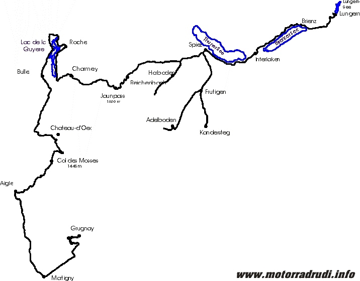
6. Day routing:
To be continued
Best greatings from Germany
and many thanks to Pete for helping with the translation!
Rudi

Background and Planning:
After the Big Alps-Loop of the summer of 2000, Werner, Lothar, Dietmar und I decided to have a closer look at Switzerland the following summer.
As I tend to quite often spent time in Switzerland and know my way around, we’d already been to some of the more out-of-the-way places, the quieter backwaters which are barely known, but which nevertheless offer exceptionell scenery and challenging roads.
To me, Switzerland as a whole embodies the Best the Alps have to offer and the personal highlights are:
1. The Bernese High Country
2. The Wallis (Swiss Rhone Valley)
3. The area around Lake Viewaldstaetter
Considering those 3 key-areas, a rough plan came together easily:
· First up the area around Appenzell
· Let’s not forget Liechtenstein!
· Lake Walensee to Lake Sihlsee
· Lake Vierwaldstätter
· Bernese High Country
· Central-Switzerland ( Furka, Grimsel, Susten, Gotthard – resp. the old Tremola-Road!)
· The Rhone Valley
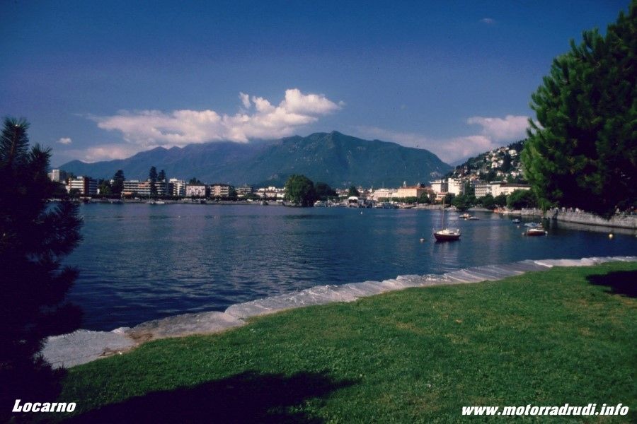
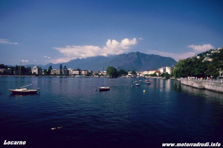
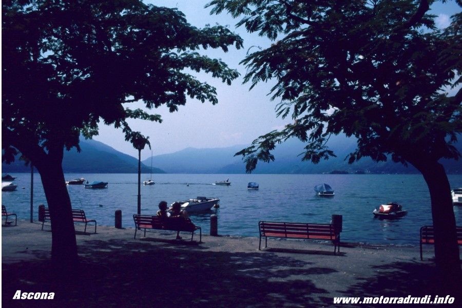
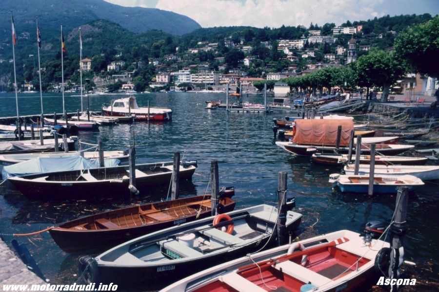
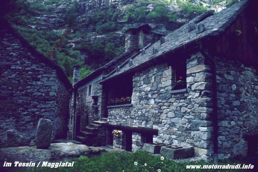
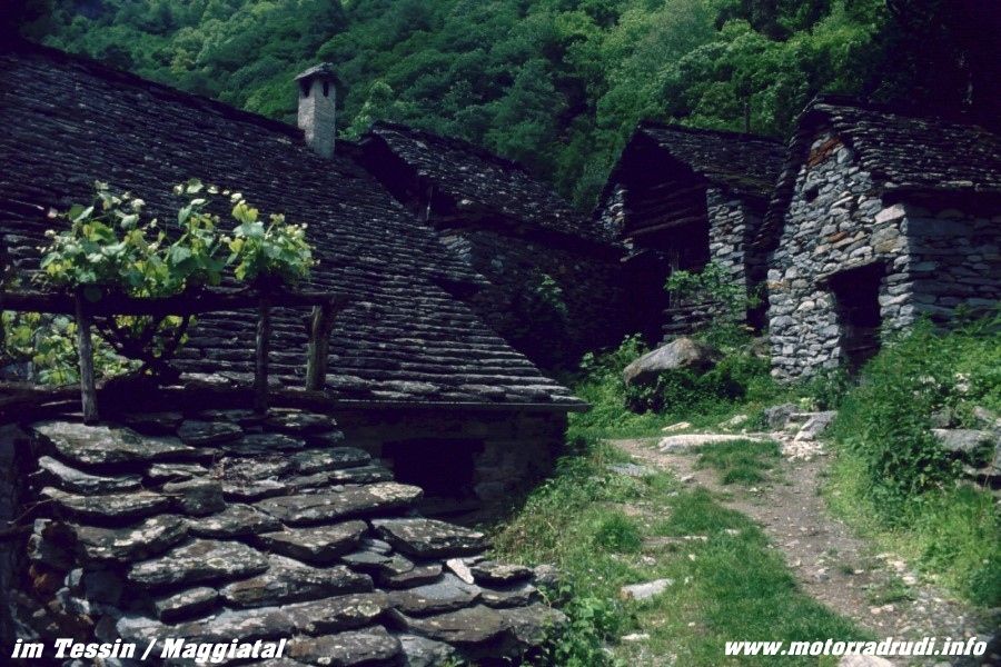
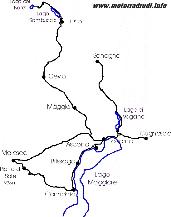
· Lago Maggiore and Lake Lugano
· Engadin (area around St. Moritz)
Here some impressions from this beautiful country:
Interlaken – Bernese High Country
beautiful mountains – Bernese High Country
Aletsch-glacier and Aletsch-forest
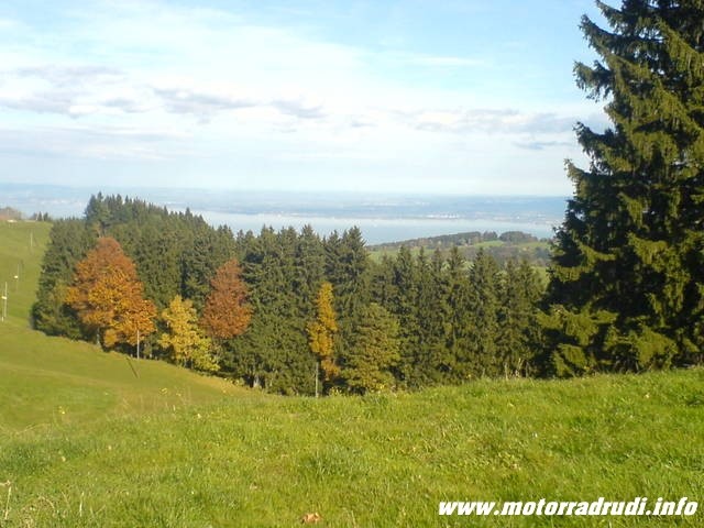
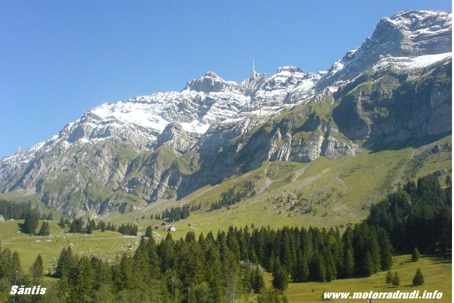
view from Säntis
Gornergrat
Castor und Pollux
Matterhorn
After lining up our timing, we were finally off on the 17.07.01:
Tues, 17.07.01, day1:
The days target was Willerzell at Lake Sihlsee, of course NOT via the direct route.
From Sonthofen via Altstädten and Fischen up the Riedbergpass (1420 m).
Altstädten
at the Riedbergpass
Then past Hittisau to Großegg and Schwarzenberg. Towards Dornbirn it’s first up the Bödele (1003 m), the downhiller shows Lake Constance in the distance. Crossing the Swiss border via Dornbirn and Lustenau, it’s Altstätten next, the gateway into the Appenzell-area.
This part of Switzerland consists of gentle hill-country, dotted with small villages....it all rather looks and feels like an outsized model-railway!
Roads are superb, gently sweeping up and down.
Via Oberegg to St. Anton, which (from the northern side) offers superb views across Lake Constance and down-valley views to Altstätten from the southern side.
St. Anton – view around
After the short stop it was across the Ruppenpass (1003 m) Appenzell and Urnäsch before the climb up to the Schwägalp (1278 m) at the foot of the Säntis Mountain.
Schwägalp
What a great road, it’s just about built for bike-riding....and things continue via Neu St. Johann and Wildhaus towards Liechtenstein.
At the start of the downhill stretch, a small road turns right across Grabserberg to Grabs, offering more excellent views, one of those typical „back-roads“ that I rather prefer. To the easier and quicker main drags.
near Grabserberg
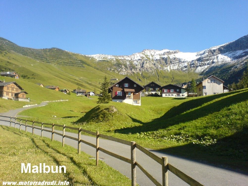
Liechtenstein came via Buchs and Schaan, the road then climbing from Vaduz to Malbun, a village in one of the furthest pockets of the tiny country. The sun put on a „light-show“, time for a quick photo-stop.
at Liechtenstein
Which included yours truly dropping the Pan European very gently onto it’s left side.
Some annoying scratches were the only damage, any more was prevented by crashbars and panniers. I still needed a little help to get her upright again though...
Despite being a dead-end, Malbun is well worth the trip, the downhill stretch paralleling the climb.
The map showed a tiny road from Mels via Portels to Flums, which somehow endet in a dead-end....doubling back, we finally found the right turn off towards Flums about halfway, a little gem of a road and decidedly preferrable to the main Sargans-Flums stretch.
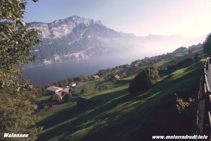
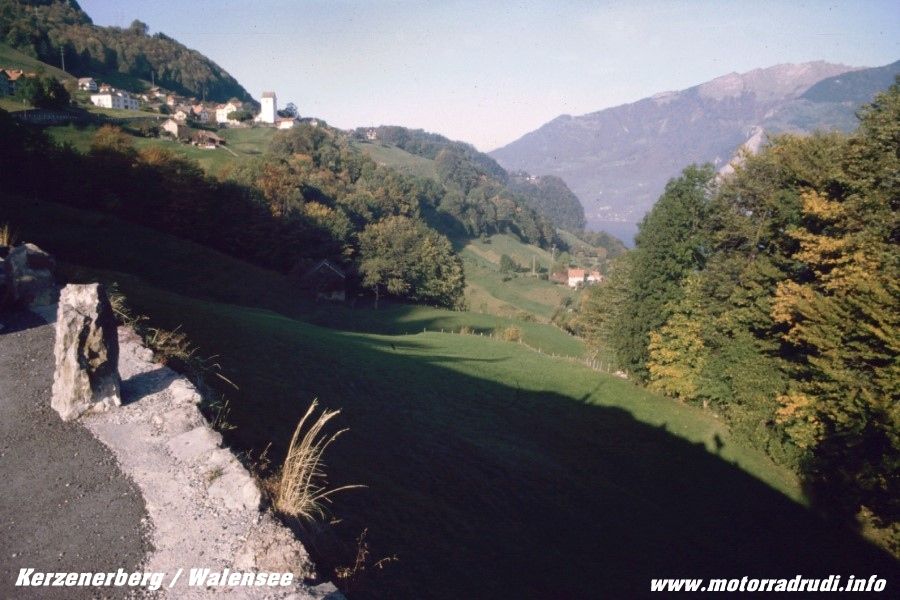
From Flums to Lake Walensee, a very scenic lake cradled by high mountains, and up to Kerenzerberg (743 m) which offers magnificent views across a picture-book landscape.
Lake Walensee
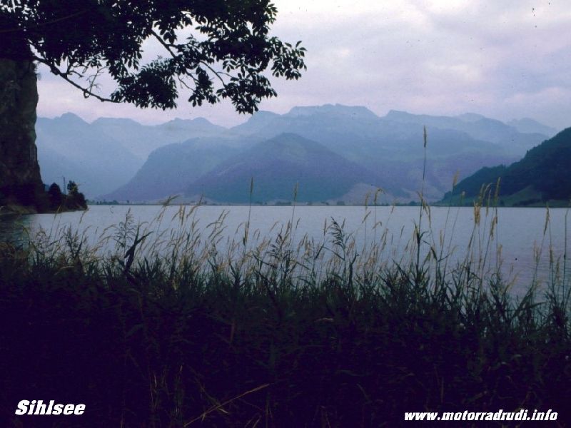
Downhill to Näfels and towards Lake Zürich-See. In Siebnen it’s a left-turn up the Sattelegg-Pass (1190 m) a delight for any 2-wheeler. The Camping area in Willerzell on Lake Sihlsee was the final stop.
Sihlsee
1. Day routing:
Wednesday, 18.07.01, Day2:
Well....the 2.day was planned to see us making our ways to Lake Vierwaltstätter, but the weather had other plans. Bucketing down right through the night and all morning, we decided on a stroll along the shores to Willerzell in the drizzle of the afternoon...
Thursday 19.07.01, Day3:
The rain has finally given way to a bright and sunny morning, let’s go then!
First up along the shores of Lake Sihlsees und up the Ibergeregg-Pass (1408 m).
I like it! A narrow road, but just nice to ride...sweepers up to the saddle and grand views onto Lake Vierwaldstätter, followed by more of the same along the way down to Schwyz.
Turning west, it’s past Lake Lauerzer to Lake Zuger.
Lake Lauerzer – view from the Rigi
Lake Zuger – view from the Rigi
Looping around the north it’s on to Lake Vierwaldstätter at Küssnacht. As mentioned before, it’s one of the most scenic parts of the Alps.
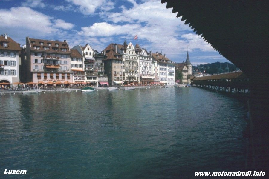
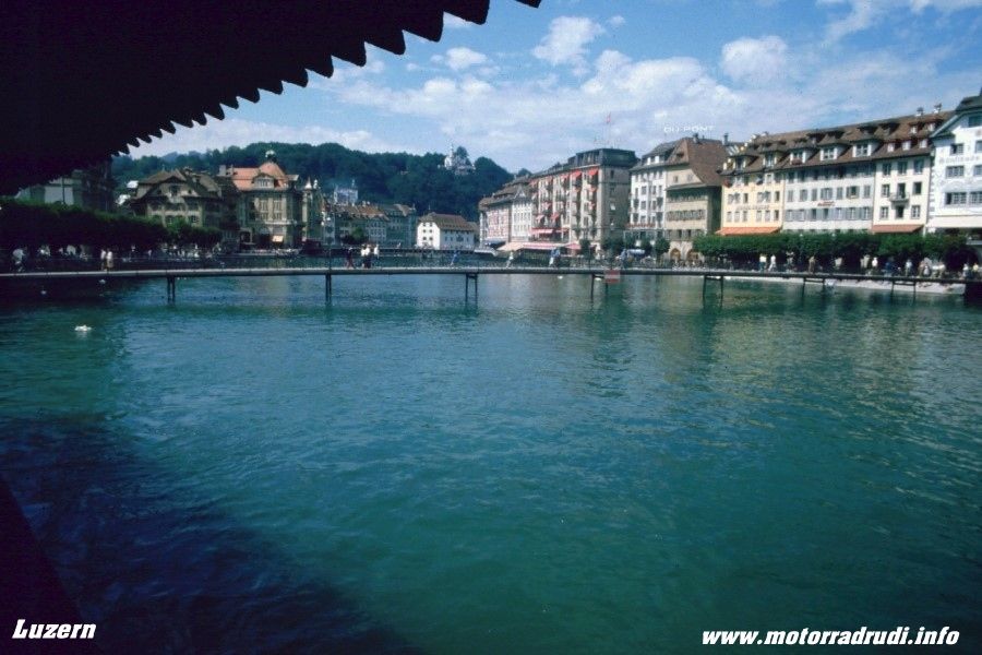
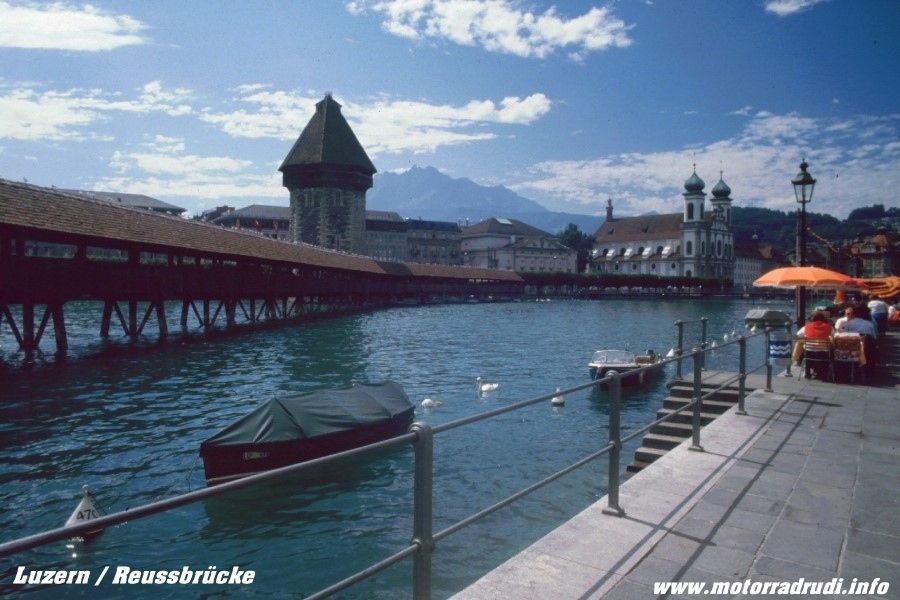
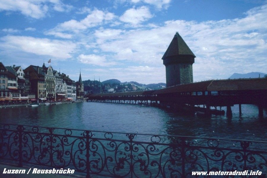
This time we took time-out for a stroll through Luzern. Always worth a visit, and not just for the old timber-bridge spanning the Reuss river, the whole town one big invite to stay and spent some time...
Luzern
Past Horw and Stansstad and southward to Lake Sarnen. Time for another diversion, this time west up the Glaubenbergpass (1543 m).
The wide , sweeping Pass makes the climb a Waltz...and down again to Entlebuch.
From there via Schüpfheim to Sörenberg and up the last Pass of the day, the Glaubenbüelenpass (1611m).
Unlike the Glaubenbergpass, this one is rather narrow and checking for oncoming traffic is essential, despite the lower traffic volume.
Lake Sarnen
Down to Lake Sarnen, the views are exquisite. Another short stretch to our target, Lake Lungern. Dietmar proved again, that he hadn’t lost any of his Chef’s skills. Tents up, feet up....life’s good !
3. Day routing:
Friday, 20.07.01, Day4
Another day of solid rain....but laughs were still had hanging around town and camp.
Saturday, 21.07.01, Day 5. :
Finally the sun’s out again, time to move on.
A 9am start saw us moving towards Central Switzerland with its famous passes of
Susten-, Grimsel- and Furka…one can NEVER get enough of those, but this time adding Oberalp-, Lukmanier- and the St. Gotthardpass… to be exact, the old Tremola-Road!
From across the Brünigpass (1008 m) to Hasliberg. It’s a dead-end, but well worth it for the views into the Bernese High Country.
From Meiringen to the Schwarzwaldalp, from here a road leads across the Grosse Scheidegg to Grindelwald, but the road is only open for local coach traffic.
No regrets though….as now the time has come for some serious pass-scratching.
Up the Sustenpass, 2224 m, past Stein Glacier – the customary stop – and up to the top. The Sustenpass, like all other passes of Central Switherland, is a riders DREAM:
Perfect roads, incredible scenery and a million bends...it’s a never-ending smaorgasboard for the senses.
Sustenpass - stoneglacier
Sustenpass
Down to Wassen, then climbing towards Andermatt. A short side-trip from Göschenen into the Göschenen Valley and the Göscheneralpsee. Completely removed from the tourist-routes, the brain is on overload, the panoramas stunning.
Back to Göschenen and on to Andermatt the next „2k“ pass is close:
The Oberalppass (2044 m) drops into the Upper Rhein Valley, leading from Disentis to Chur. More bends, more views, more perfect bends.... Via Disentis onto the Lukmanierpass, with 1914 m just shy of the „2k“ mark.
Despite that...the riding-dream continues towards Biasca, then direction Airolo. Here, the old Tremola-Road climbs up the St. Gotthardpass (2108 m). The old (now by-passed) pass-road still has it’s sections of cobblestone paving... despite it’s bumpiness and treacherous character when wet, it’s an absolute MUST if in the area.
Tremola (the old St. Gotthard-route)
Andermatt
Descending the other side into Hospental it’s a short turn west to climb the next ‚Biggie“, the Furkapass, 2431 m, the undisputed highlight of the day.
Unlike the other passes of Central Switzerland, the road is rather narrow and one has to keep a constant eye on traffic.
Magic bends and sweepers lead to the top, the descent passes close to the mouth of the Rhone Glacier, which, as most other glaciers of the Alps, is receding more and more, year by year. Still, it’s a very impressive sight.
Rolling into Gletsch the dream wasn’t over yet. One more ‚2k“ for the day... the Grimselpass (2165 m), again offering everything, that makes a rider’s dream:
Superb road, superb views...and bends, bends, bends with little traffic.
Grimselpass – view to the Rhoneglacier
Past Lake Grimsel and Lake Räterichsboden towards Meiringen. From here, a quick hop across the Brünigpass (1008 m) back to Lungern.
Lake Lungern
While the other 3 had enough after a full-day-rollercoaster, I’d discovered a tiny road leading up the hill from the campsite...climbing 1000m over 10km. The reward was a fantastic view into the Meiringen Valley and the Bernese Ice-giants in the distance, a well-worth effort crowned by another Dietmar dinner-delight.
Lake Lungern
5. Day routing:
Sunday, 22.07.01, Day 6. :
Under blue skies it was up the Brünig-Pass (1008 m) for another one of those things “not-to-be-missed”: the open-air museum at Ballenberg.
Integrated into the surrounds and crowned by mountain ranges, it’s a collection of buildings showing off the different building styles found within Switzerland, a worthwhile visit!
Count on spending around 3-4hrs…my 3 travelling mates were just as impressed as myself, even though I’d been there before.
open-air museum Ballenberg
The afternoon brought us into the Bernese High Country, which, I reckon, is the most picturesque part of the whole Alps region. STUNNING !!!!!
Along the shores of Lake Brienzer to Interlaken and Wilderswil.
Lake Brienz
Then the narrow road up to Saxeten, escaping into tranquillity above the hustle and bustle of Interlaken, Lauterbrunnen and Grindelwald. It’s a small, picturesque village with beautiful buildings and a superb pub offering lunch.
Saxeten
Back down into the valley and through Grindelwald to the mouth of the Grindelwald Glacier, an imposing sight, where the road meets up with the one taken from Schwarzwaldalp yesterday (the one only open for local coach traffic).
From Grindelwald via Lauterbrunnen to Stechelberg. At Lauterbrunnen awaits another natural attraction: the Staubbachfall, a waterfall plunging 300m into the valley.
Towards Stechelberg are the Trümmelbachwasserfälle, a series of 10 glacier-fed waterfalls inside the mountain face, accessed by a tunnel-lift.
But there were other highlights waiting…back to Interlaken and up to Habkern.
The road looks like leading nowhere, but turning left in the last hairpin before the village, the small toll-road leads to Waldegg and Beatenberg, offering breathtaking views of the “Holy Triple” of the Bernese alps: Eiger, Mönch and Jungfrau, the 3 ice giants.
Eiger, Mönch and Jungfrau
Easy to see the attraction to climbers from all over the world.
From Beatenberg another small toll-road leads through various tunnels to Sigriswill, offering brilliant views onto Lake Thun below and most of the Bernese High Country above.
The map showed another small road from Sigriswill via Maiersmaad, Horrenbach and Eriz onto the Schallenberg Pass road, the landscape turning into the total opposite…gentle green hills, shallow valleys…roads turn from bends to sweepers.
Sort of like Scotland…and the narrow road showed little traffic.
Across the Schallenberg (1167 m) and through Escholzmatt across the
Glaubenbüelenpass (1611 m) again back to ‘base-camp” at Lake Lungern.
6. Day routing:
To be continued
Best greatings from Germany
and many thanks to Pete for helping with the translation!
Rudi


 for a living