


J
Jantar
Guest
A day off work and a resonable weather forecast gave me the perfect opportunity for part 2 of the escapde. There was a front due to hit the area around 7:00 pm tonight, but I figured I could easily be finished by then. This section starts in my own town of Alexandra.
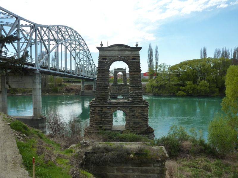
Alexandra is a rural town the supports the local summerfruit industry. It is at the confluence of the Clutha and the Manuherikia Rivers. In the early gold rush days the Clutha River could only be crossed by barge. that was replaced by a suspension bridge which has since been replaced by a steel girder bridge.
The remains of the old bridge alongside the new one:
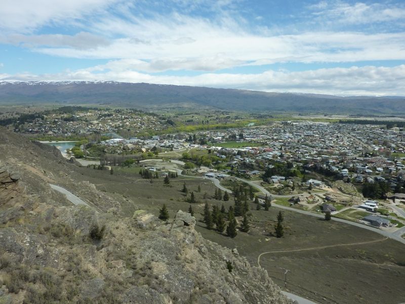
Above the township is a good lookout allowing a view across the town and the surrounding fruitgrowing areas.:
From Alexandra I headed 26 km east to Omakau for the next question in the Escapade. However when I got to Omakau I realised that I had my camera, my GPS, my fuel cards, but I did not have the route or the list of questions. From Omakau I headed 26 km west back to Alexandra and passed a group of bikes going in the opposite direction (the direction I should have been going). With the route sheet and questions in my jacket pocket I headed 26 km east to Omakau for the next question in the Escapade. It was a lovely day to park right next to the Dead Center of Omakau.
To go further east from Omakau there are two possible routes. They are within 2 km of each other in length and take a similar length of time. The escapade route required me to take the northern of the two routes through Becks then into the region know as the Maniototo and onto Naseby.
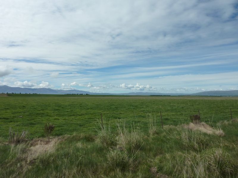
This area is 2000 feet above sea level but very flat. Those hills in the distance is where I'm headed:
There was a bonus question in Ranfurly and although I could have just bypassed that one, it only added on a few km extra. From here it was up to the Pig Route, one of the best road rides in Otago. Plenty of up hill and down hill with sweeping bends and glorious scenery. I was having too much fun just enjoying the ride to stop and take any photos.
One of the questions was in a rest area at the bottom of a hill, and it was here I learned something about myself. I must be a scary looking buggar in black leathers when on my bike. While I was stopped to get the answer to a question a car came down the hill and indicated to turn into the rest area. As it started to turn in, the driver saw me, stopped then turned back onto the road and continued east. Futher down the road a bit later I saw the same car parked in another area that wasn't as nice and the two occupants were eating their lunch.
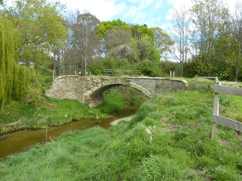
I stopped at Duntroon at this historic bridge. I would be reluctant to walk over it let alone take a vehicle over it:
Alexandra is a rural town the supports the local summerfruit industry. It is at the confluence of the Clutha and the Manuherikia Rivers. In the early gold rush days the Clutha River could only be crossed by barge. that was replaced by a suspension bridge which has since been replaced by a steel girder bridge.
The remains of the old bridge alongside the new one:

Above the township is a good lookout allowing a view across the town and the surrounding fruitgrowing areas.:

From Alexandra I headed 26 km east to Omakau for the next question in the Escapade. However when I got to Omakau I realised that I had my camera, my GPS, my fuel cards, but I did not have the route or the list of questions. From Omakau I headed 26 km west back to Alexandra and passed a group of bikes going in the opposite direction (the direction I should have been going). With the route sheet and questions in my jacket pocket I headed 26 km east to Omakau for the next question in the Escapade. It was a lovely day to park right next to the Dead Center of Omakau.

To go further east from Omakau there are two possible routes. They are within 2 km of each other in length and take a similar length of time. The escapade route required me to take the northern of the two routes through Becks then into the region know as the Maniototo and onto Naseby.
This area is 2000 feet above sea level but very flat. Those hills in the distance is where I'm headed:

There was a bonus question in Ranfurly and although I could have just bypassed that one, it only added on a few km extra. From here it was up to the Pig Route, one of the best road rides in Otago. Plenty of up hill and down hill with sweeping bends and glorious scenery. I was having too much fun just enjoying the ride to stop and take any photos.
One of the questions was in a rest area at the bottom of a hill, and it was here I learned something about myself. I must be a scary looking buggar in black leathers when on my bike. While I was stopped to get the answer to a question a car came down the hill and indicated to turn into the rest area. As it started to turn in, the driver saw me, stopped then turned back onto the road and continued east. Futher down the road a bit later I saw the same car parked in another area that wasn't as nice and the two occupants were eating their lunch.
I stopped at Duntroon at this historic bridge. I would be reluctant to walk over it let alone take a vehicle over it:

Last edited:


